You are here: Home > Network List > TA - USArray Transportable Network (new EarthScope stations) Stations List
> Station R32K Eaglecrest, AK, USA > Earthquake Result Viewer
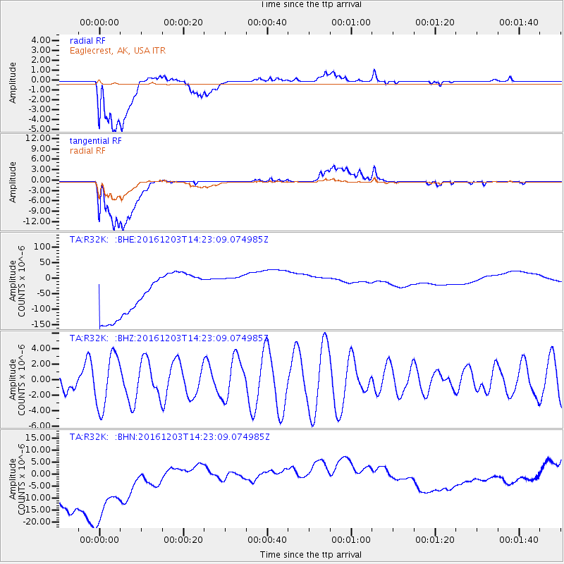
R32K Eaglecrest, AK, USA - Earthquake Result Viewer
*The percent match for this event was below the threshold and hence no stack was calculated.
| Earthquake location: |
South Of Fiji Islands |
| Earthquake latitude/longitude: |
-22.6/-176.0 |
| Earthquake time(UTC): |
2016/12/03 (338) 14:11:09 GMT |
| Earthquake Depth: |
153 km |
| Earthquake Magnitude: |
5.5 mb |
| Earthquake Catalog/Contributor: |
NEIC PDE/us |
|
| Network: |
TA USArray Transportable Network (new EarthScope stations) |
| Station: |
R32K Eaglecrest, AK, USA |
| Lat/Lon: |
58.27 N/134.52 W |
| Elevation: |
386 m |
|
| Distance: |
87.6 deg |
| Az: |
20.518 deg |
| Baz: |
217.811 deg |
| Ray Param: |
$rayparam |
*The percent match for this event was below the threshold and hence was not used in the summary stack. |
|
| Radial Match: |
23.438221 % |
| Radial Bump: |
400 |
| Transverse Match: |
26.435366 % |
| Transverse Bump: |
400 |
| SOD ConfigId: |
11737051 |
| Insert Time: |
2019-04-26 05:10:54.087 +0000 |
| GWidth: |
2.5 |
| Max Bumps: |
400 |
| Tol: |
0.001 |
|
Signal To Noise
| Channel | StoN | STA | LTA |
| TA:R32K: :BHZ:20161203T14:23:09.074985Z | 1.7913599 | 3.493368E-6 | 1.9501208E-6 |
| TA:R32K: :BHN:20161203T14:23:09.074985Z | 1.3307111 | 3.3996963E-5 | 2.5547968E-5 |
| TA:R32K: :BHE:20161203T14:23:09.074985Z | 0.81902546 | 5.3330245E-5 | 6.511427E-5 |
| Arrivals |
| Ps | |
| PpPs | |
| PsPs/PpSs | |


