You are here: Home > Network List > CN - Canadian National Seismograph Network Stations List
> Station INK INUVIK, NT > Earthquake Result Viewer
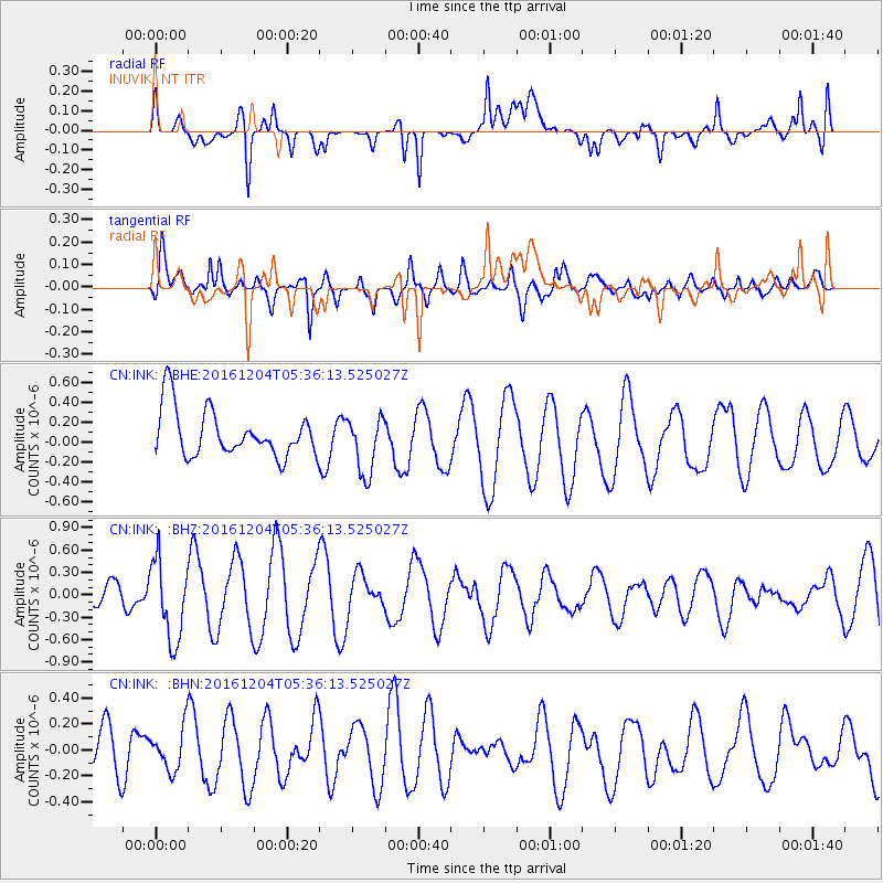
INK INUVIK, NT - Earthquake Result Viewer
*The percent match for this event was below the threshold and hence no stack was calculated.
| Earthquake location: |
Talaud Islands, Indonesia |
| Earthquake latitude/longitude: |
4.5/127.8 |
| Earthquake time(UTC): |
2016/12/04 (339) 05:24:05 GMT |
| Earthquake Depth: |
142 km |
| Earthquake Magnitude: |
5.7 mb |
| Earthquake Catalog/Contributor: |
NEIC PDE/us |
|
| Network: |
CN Canadian National Seismograph Network |
| Station: |
INK INUVIK, NT |
| Lat/Lon: |
68.31 N/133.53 W |
| Elevation: |
44 m |
|
| Distance: |
89.0 deg |
| Az: |
21.569 deg |
| Baz: |
279.674 deg |
| Ray Param: |
$rayparam |
*The percent match for this event was below the threshold and hence was not used in the summary stack. |
|
| Radial Match: |
61.86129 % |
| Radial Bump: |
400 |
| Transverse Match: |
50.676502 % |
| Transverse Bump: |
379 |
| SOD ConfigId: |
11737051 |
| Insert Time: |
2019-04-26 05:15:19.030 +0000 |
| GWidth: |
2.5 |
| Max Bumps: |
400 |
| Tol: |
0.001 |
|
Signal To Noise
| Channel | StoN | STA | LTA |
| CN:INK: :BHZ:20161204T05:36:13.525027Z | 2.2732956 | 5.3839307E-7 | 2.3683374E-7 |
| CN:INK: :BHN:20161204T05:36:13.525027Z | 0.87611514 | 1.6355447E-7 | 1.8668149E-7 |
| CN:INK: :BHE:20161204T05:36:13.525027Z | 1.2449579 | 2.9534164E-7 | 2.3723022E-7 |
| Arrivals |
| Ps | |
| PpPs | |
| PsPs/PpSs | |


