You are here: Home > Network List > IU - Global Seismograph Network (GSN - IRIS/USGS) Stations List
> Station PMG Port Moresby, New Guinea > Earthquake Result Viewer
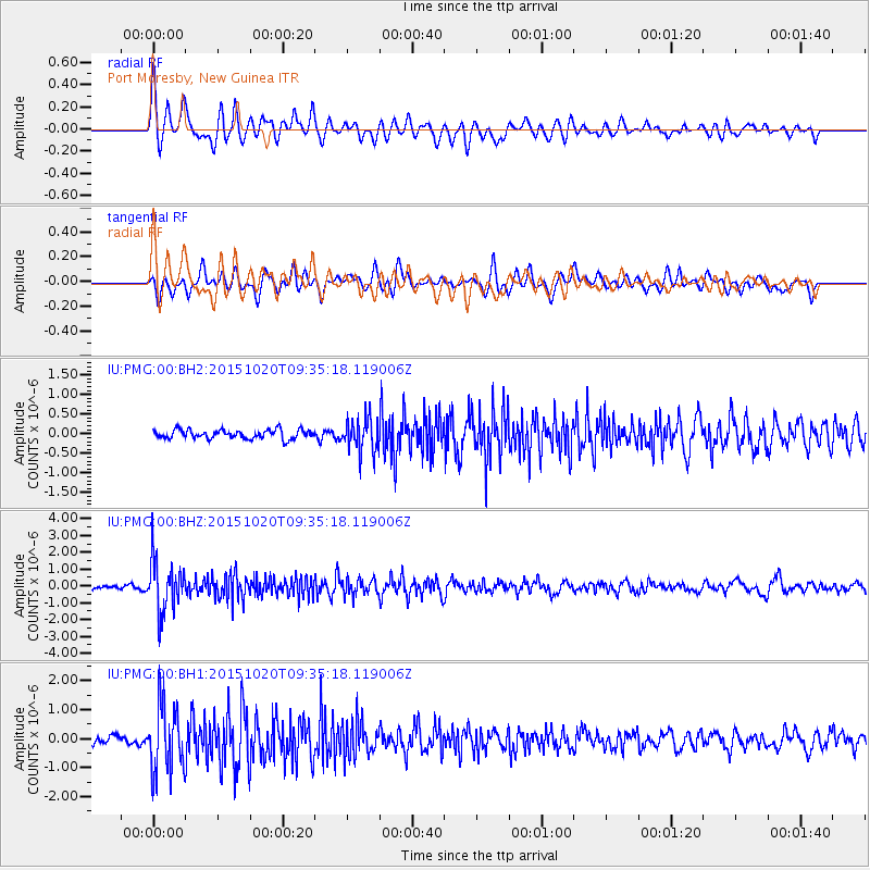
PMG Port Moresby, New Guinea - Earthquake Result Viewer
*The percent match for this event was below the threshold and hence no stack was calculated.
| Earthquake location: |
Bonin Islands, Japan Region |
| Earthquake latitude/longitude: |
27.0/140.3 |
| Earthquake time(UTC): |
2015/10/20 (293) 09:29:08 GMT |
| Earthquake Depth: |
300 km |
| Earthquake Magnitude: |
5.5 MB |
| Earthquake Catalog/Contributor: |
NEIC PDE/NEIC COMCAT |
|
| Network: |
IU Global Seismograph Network (GSN - IRIS/USGS) |
| Station: |
PMG Port Moresby, New Guinea |
| Lat/Lon: |
9.40 S/147.16 E |
| Elevation: |
90 m |
|
| Distance: |
36.8 deg |
| Az: |
168.599 deg |
| Baz: |
349.707 deg |
| Ray Param: |
$rayparam |
*The percent match for this event was below the threshold and hence was not used in the summary stack. |
|
| Radial Match: |
72.60244 % |
| Radial Bump: |
400 |
| Transverse Match: |
68.915695 % |
| Transverse Bump: |
400 |
| SOD ConfigId: |
1259291 |
| Insert Time: |
2015-11-03 10:08:00.389 +0000 |
| GWidth: |
2.5 |
| Max Bumps: |
400 |
| Tol: |
0.001 |
|
Signal To Noise
| Channel | StoN | STA | LTA |
| IU:PMG:00:BHZ:20151020T09:35:18.119006Z | 10.284821 | 1.5301692E-6 | 1.4877938E-7 |
| IU:PMG:00:BH1:20151020T09:35:18.119006Z | 11.161829 | 1.1541586E-6 | 1.0340228E-7 |
| IU:PMG:00:BH2:20151020T09:35:18.119006Z | 3.7243555 | 4.202737E-7 | 1.1284468E-7 |
| Arrivals |
| Ps | |
| PpPs | |
| PsPs/PpSs | |


