You are here: Home > Network List > TA - USArray Transportable Network (new EarthScope stations) Stations List
> Station A21K Barrow, AK, USA > Earthquake Result Viewer
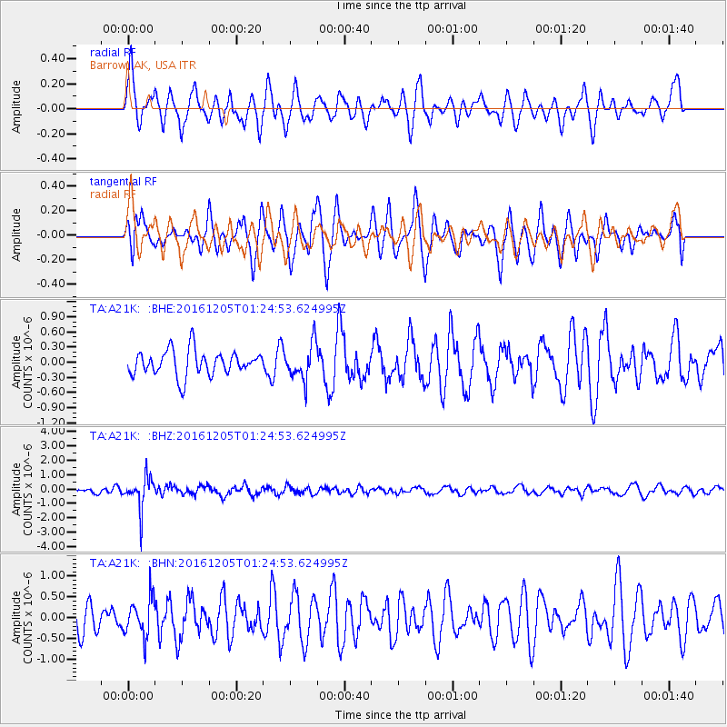
A21K Barrow, AK, USA - Earthquake Result Viewer
*The percent match for this event was below the threshold and hence no stack was calculated.
| Earthquake location: |
Banda Sea |
| Earthquake latitude/longitude: |
-7.3/123.4 |
| Earthquake time(UTC): |
2016/12/05 (340) 01:13:04 GMT |
| Earthquake Depth: |
526 km |
| Earthquake Magnitude: |
6.3 Mww |
| Earthquake Catalog/Contributor: |
NEIC PDE/us |
|
| Network: |
TA USArray Transportable Network (new EarthScope stations) |
| Station: |
A21K Barrow, AK, USA |
| Lat/Lon: |
71.32 N/156.62 W |
| Elevation: |
577 m |
|
| Distance: |
93.7 deg |
| Az: |
18.539 deg |
| Baz: |
258.217 deg |
| Ray Param: |
$rayparam |
*The percent match for this event was below the threshold and hence was not used in the summary stack. |
|
| Radial Match: |
47.411304 % |
| Radial Bump: |
400 |
| Transverse Match: |
65.413635 % |
| Transverse Bump: |
396 |
| SOD ConfigId: |
11737051 |
| Insert Time: |
2019-04-26 05:22:07.866 +0000 |
| GWidth: |
2.5 |
| Max Bumps: |
400 |
| Tol: |
0.001 |
|
Signal To Noise
| Channel | StoN | STA | LTA |
| TA:A21K: :BHZ:20161205T01:24:53.624995Z | 5.454026 | 1.1398108E-6 | 2.089852E-7 |
| TA:A21K: :BHN:20161205T01:24:53.624995Z | 1.1570448 | 4.534071E-7 | 3.918665E-7 |
| TA:A21K: :BHE:20161205T01:24:53.624995Z | 1.4507215 | 3.616808E-7 | 2.4931097E-7 |
| Arrivals |
| Ps | |
| PpPs | |
| PsPs/PpSs | |


