You are here: Home > Network List > IW - Intermountain West Stations List
> Station PLID Pearl Lake, Idaho, USA > Earthquake Result Viewer
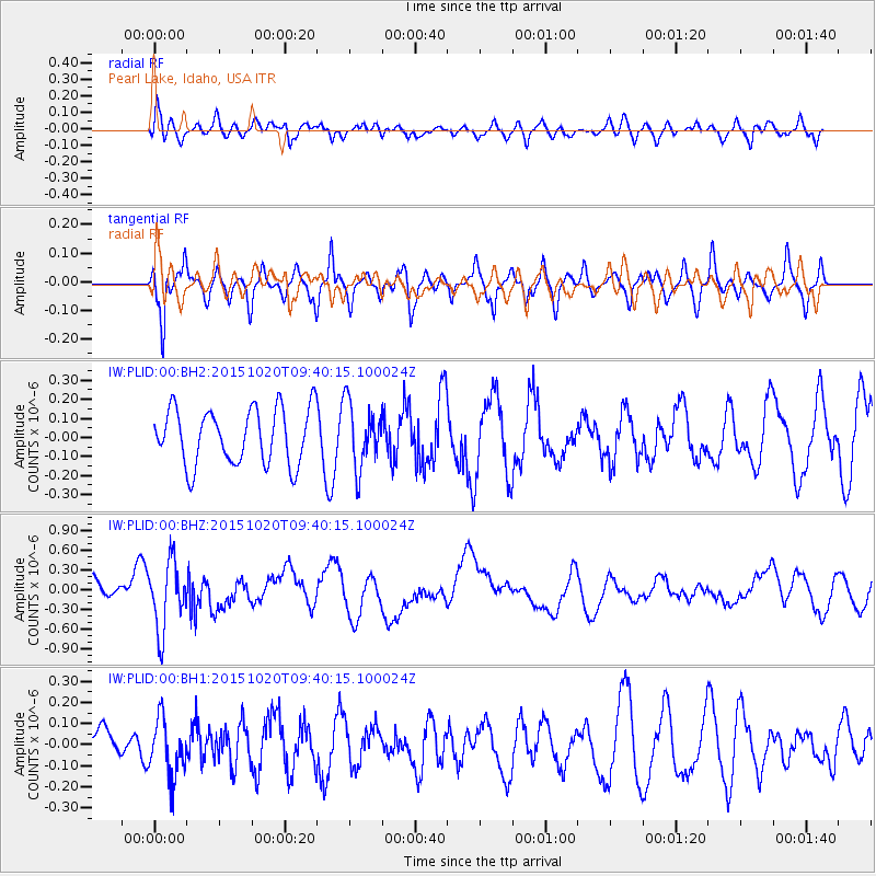
PLID Pearl Lake, Idaho, USA - Earthquake Result Viewer
*The percent match for this event was below the threshold and hence no stack was calculated.
| Earthquake location: |
Bonin Islands, Japan Region |
| Earthquake latitude/longitude: |
27.0/140.3 |
| Earthquake time(UTC): |
2015/10/20 (293) 09:29:08 GMT |
| Earthquake Depth: |
300 km |
| Earthquake Magnitude: |
5.5 MB |
| Earthquake Catalog/Contributor: |
NEIC PDE/NEIC COMCAT |
|
| Network: |
IW Intermountain West |
| Station: |
PLID Pearl Lake, Idaho, USA |
| Lat/Lon: |
45.09 N/116.00 W |
| Elevation: |
2164 m |
|
| Distance: |
80.3 deg |
| Az: |
44.281 deg |
| Baz: |
298.465 deg |
| Ray Param: |
$rayparam |
*The percent match for this event was below the threshold and hence was not used in the summary stack. |
|
| Radial Match: |
54.2346 % |
| Radial Bump: |
400 |
| Transverse Match: |
73.36768 % |
| Transverse Bump: |
400 |
| SOD ConfigId: |
1259291 |
| Insert Time: |
2015-11-03 10:08:57.728 +0000 |
| GWidth: |
2.5 |
| Max Bumps: |
400 |
| Tol: |
0.001 |
|
Signal To Noise
| Channel | StoN | STA | LTA |
| IW:PLID:00:BHZ:20151020T09:40:15.100024Z | 2.8803408 | 5.129098E-7 | 1.7807261E-7 |
| IW:PLID:00:BH1:20151020T09:40:15.100024Z | 1.3231343 | 1.3531972E-7 | 1.02272104E-7 |
| IW:PLID:00:BH2:20151020T09:40:15.100024Z | 1.1524432 | 1.6798725E-7 | 1.457662E-7 |
| Arrivals |
| Ps | |
| PpPs | |
| PsPs/PpSs | |


