You are here: Home > Network List > CI - Caltech Regional Seismic Network Stations List
> Station SWS Sam W. Stewart, Westmorland, CA, USA > Earthquake Result Viewer
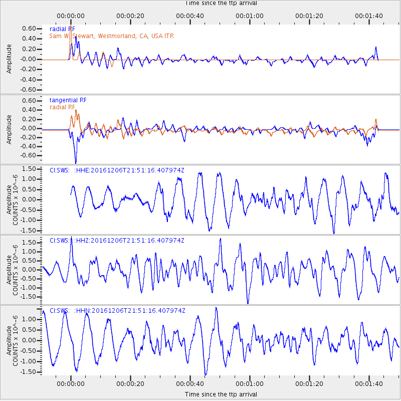
SWS Sam W. Stewart, Westmorland, CA, USA - Earthquake Result Viewer
*The percent match for this event was below the threshold and hence no stack was calculated.
| Earthquake location: |
Windward Islands |
| Earthquake latitude/longitude: |
11.1/-60.9 |
| Earthquake time(UTC): |
2016/12/06 (341) 21:42:21 GMT |
| Earthquake Depth: |
35 km |
| Earthquake Magnitude: |
5.9 Mww |
| Earthquake Catalog/Contributor: |
NEIC PDE/us |
|
| Network: |
CI Caltech Regional Seismic Network |
| Station: |
SWS Sam W. Stewart, Westmorland, CA, USA |
| Lat/Lon: |
32.94 N/115.80 W |
| Elevation: |
140 m |
|
| Distance: |
54.7 deg |
| Az: |
302.545 deg |
| Baz: |
100.245 deg |
| Ray Param: |
$rayparam |
*The percent match for this event was below the threshold and hence was not used in the summary stack. |
|
| Radial Match: |
57.561478 % |
| Radial Bump: |
356 |
| Transverse Match: |
57.918823 % |
| Transverse Bump: |
400 |
| SOD ConfigId: |
11737051 |
| Insert Time: |
2019-04-26 05:26:43.097 +0000 |
| GWidth: |
2.5 |
| Max Bumps: |
400 |
| Tol: |
0.001 |
|
Signal To Noise
| Channel | StoN | STA | LTA |
| CI:SWS: :HHZ:20161206T21:51:16.407974Z | 3.0597699 | 7.459216E-7 | 2.4378357E-7 |
| CI:SWS: :HHN:20161206T21:51:16.407974Z | 1.313533 | 7.8398944E-7 | 5.968555E-7 |
| CI:SWS: :HHE:20161206T21:51:16.407974Z | 1.7224153 | 6.28107E-7 | 3.6466642E-7 |
| Arrivals |
| Ps | |
| PpPs | |
| PsPs/PpSs | |


