You are here: Home > Network List > CN - Canadian National Seismograph Network Stations List
> Station INK INUVIK, NT > Earthquake Result Viewer
INK INUVIK, NT - Earthquake Result Viewer
*The percent match for this event was below the threshold and hence no stack was calculated.
| Earthquake location: |
Windward Islands |
| Earthquake latitude/longitude: |
11.1/-60.9 |
| Earthquake time(UTC): |
2016/12/06 (341) 21:42:21 GMT |
| Earthquake Depth: |
35 km |
| Earthquake Magnitude: |
5.9 Mww |
| Earthquake Catalog/Contributor: |
NEIC PDE/us |
|
| Network: |
CN Canadian National Seismograph Network |
| Station: |
INK INUVIK, NT |
| Lat/Lon: |
68.31 N/133.53 W |
| Elevation: |
44 m |
|
| Distance: |
73.4 deg |
| Az: |
338.266 deg |
| Baz: |
102.125 deg |
| Ray Param: |
$rayparam |
*The percent match for this event was below the threshold and hence was not used in the summary stack. |
|
| Radial Match: |
64.46627 % |
| Radial Bump: |
400 |
| Transverse Match: |
52.88907 % |
| Transverse Bump: |
400 |
| SOD ConfigId: |
11737051 |
| Insert Time: |
2019-04-26 05:27:02.292 +0000 |
| GWidth: |
2.5 |
| Max Bumps: |
400 |
| Tol: |
0.001 |
|
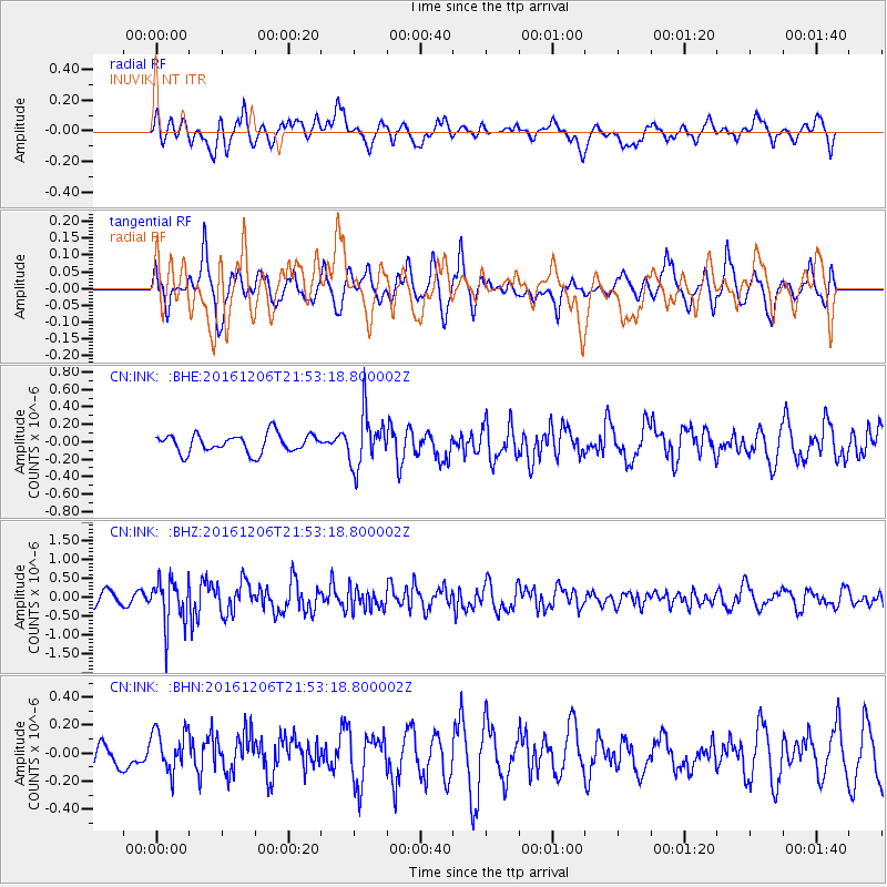
Signal To Noise
| Channel | StoN | STA | LTA |
| CN:INK: :BHZ:20161206T21:53:18.800002Z | 3.7511954 | 6.204416E-7 | 1.6539836E-7 |
| CN:INK: :BHN:20161206T21:53:18.800002Z | 1.0846988 | 1.5420473E-7 | 1.4216363E-7 |
| CN:INK: :BHE:20161206T21:53:18.800002Z | 2.890037 | 3.0632688E-7 | 1.05994104E-7 |
| Arrivals |
| Ps | |
| PpPs | |
| PsPs/PpSs | |


