You are here: Home > Network List > US - United States National Seismic Network Stations List
> Station EGMT Eagleton, Montana, USA > Earthquake Result Viewer
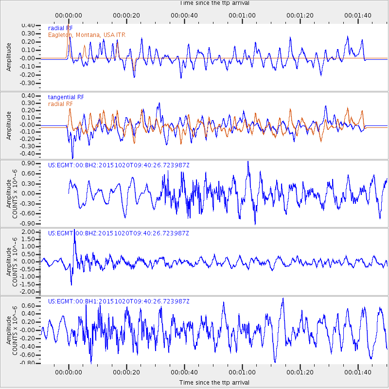
EGMT Eagleton, Montana, USA - Earthquake Result Viewer
*The percent match for this event was below the threshold and hence no stack was calculated.
| Earthquake location: |
Bonin Islands, Japan Region |
| Earthquake latitude/longitude: |
27.0/140.3 |
| Earthquake time(UTC): |
2015/10/20 (293) 09:29:08 GMT |
| Earthquake Depth: |
300 km |
| Earthquake Magnitude: |
5.5 MB |
| Earthquake Catalog/Contributor: |
NEIC PDE/NEIC COMCAT |
|
| Network: |
US United States National Seismic Network |
| Station: |
EGMT Eagleton, Montana, USA |
| Lat/Lon: |
48.02 N/109.75 W |
| Elevation: |
1055 m |
|
| Distance: |
82.5 deg |
| Az: |
39.518 deg |
| Baz: |
302.274 deg |
| Ray Param: |
$rayparam |
*The percent match for this event was below the threshold and hence was not used in the summary stack. |
|
| Radial Match: |
42.50848 % |
| Radial Bump: |
400 |
| Transverse Match: |
68.35871 % |
| Transverse Bump: |
400 |
| SOD ConfigId: |
1259291 |
| Insert Time: |
2015-11-03 10:10:49.161 +0000 |
| GWidth: |
2.5 |
| Max Bumps: |
400 |
| Tol: |
0.001 |
|
Signal To Noise
| Channel | StoN | STA | LTA |
| US:EGMT:00:BHZ:20151020T09:40:26.723987Z | 4.6827826 | 7.2038415E-7 | 1.5383677E-7 |
| US:EGMT:00:BH1:20151020T09:40:26.723987Z | 1.1318228 | 2.0180357E-7 | 1.7829962E-7 |
| US:EGMT:00:BH2:20151020T09:40:26.723987Z | 1.072031 | 2.8995547E-7 | 2.70473E-7 |
| Arrivals |
| Ps | |
| PpPs | |
| PsPs/PpSs | |


