You are here: Home > Network List > US - United States National Seismic Network Stations List
> Station ELK Elko, Nevada, USA > Earthquake Result Viewer
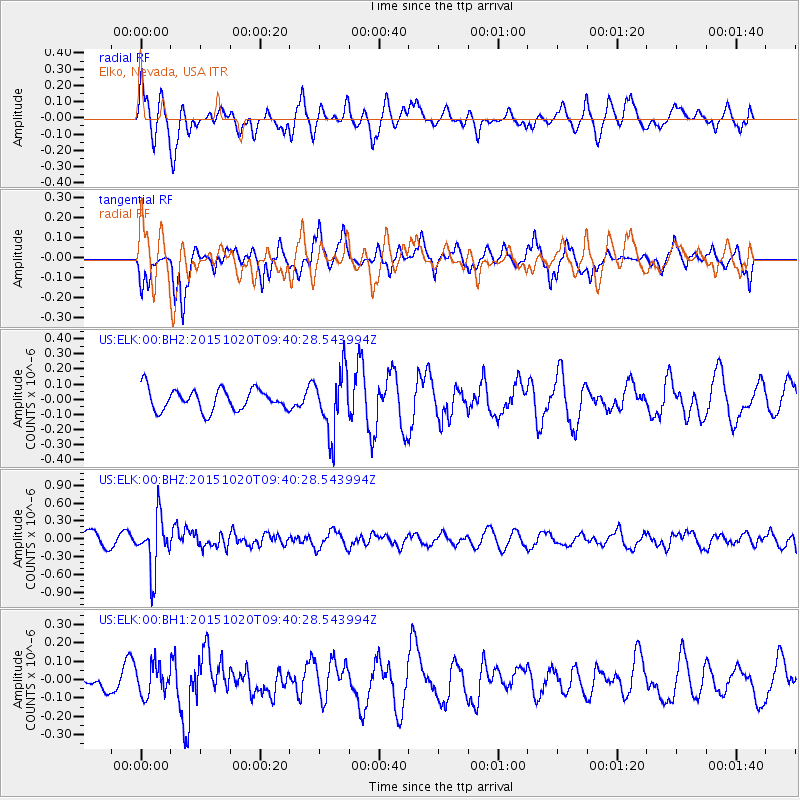
ELK Elko, Nevada, USA - Earthquake Result Viewer
*The percent match for this event was below the threshold and hence no stack was calculated.
| Earthquake location: |
Bonin Islands, Japan Region |
| Earthquake latitude/longitude: |
27.0/140.3 |
| Earthquake time(UTC): |
2015/10/20 (293) 09:29:08 GMT |
| Earthquake Depth: |
300 km |
| Earthquake Magnitude: |
5.5 MB |
| Earthquake Catalog/Contributor: |
NEIC PDE/NEIC COMCAT |
|
| Network: |
US United States National Seismic Network |
| Station: |
ELK Elko, Nevada, USA |
| Lat/Lon: |
40.74 N/115.24 W |
| Elevation: |
2210 m |
|
| Distance: |
82.9 deg |
| Az: |
47.845 deg |
| Baz: |
299.505 deg |
| Ray Param: |
$rayparam |
*The percent match for this event was below the threshold and hence was not used in the summary stack. |
|
| Radial Match: |
69.95581 % |
| Radial Bump: |
400 |
| Transverse Match: |
62.92605 % |
| Transverse Bump: |
359 |
| SOD ConfigId: |
1259291 |
| Insert Time: |
2015-11-03 10:10:55.103 +0000 |
| GWidth: |
2.5 |
| Max Bumps: |
400 |
| Tol: |
0.001 |
|
Signal To Noise
| Channel | StoN | STA | LTA |
| US:ELK:00:BHZ:20151020T09:40:28.543994Z | 3.878016 | 4.5291065E-7 | 1.16789266E-7 |
| US:ELK:00:BH1:20151020T09:40:28.543994Z | 0.8442286 | 8.058738E-8 | 9.545681E-8 |
| US:ELK:00:BH2:20151020T09:40:28.543994Z | 2.8510284 | 2.0141475E-7 | 7.064635E-8 |
| Arrivals |
| Ps | |
| PpPs | |
| PsPs/PpSs | |


