You are here: Home > Network List > US - United States National Seismic Network Stations List
> Station HAWA Hanford, Washington, USA > Earthquake Result Viewer
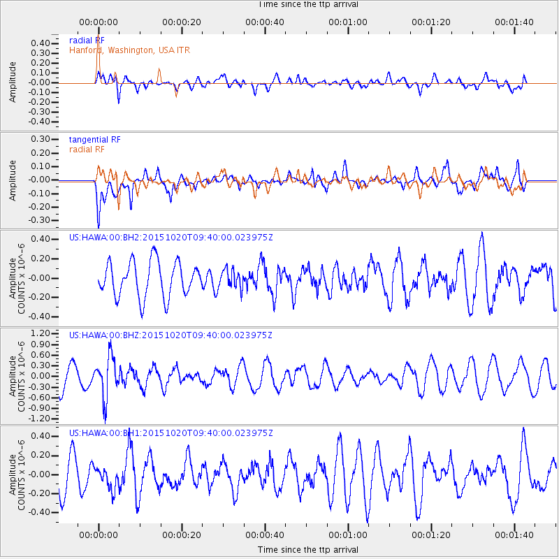
HAWA Hanford, Washington, USA - Earthquake Result Viewer
*The percent match for this event was below the threshold and hence no stack was calculated.
| Earthquake location: |
Bonin Islands, Japan Region |
| Earthquake latitude/longitude: |
27.0/140.3 |
| Earthquake time(UTC): |
2015/10/20 (293) 09:29:08 GMT |
| Earthquake Depth: |
300 km |
| Earthquake Magnitude: |
5.5 MB |
| Earthquake Catalog/Contributor: |
NEIC PDE/NEIC COMCAT |
|
| Network: |
US United States National Seismic Network |
| Station: |
HAWA Hanford, Washington, USA |
| Lat/Lon: |
46.39 N/119.53 W |
| Elevation: |
364 m |
|
| Distance: |
77.5 deg |
| Az: |
44.251 deg |
| Baz: |
295.937 deg |
| Ray Param: |
$rayparam |
*The percent match for this event was below the threshold and hence was not used in the summary stack. |
|
| Radial Match: |
53.46093 % |
| Radial Bump: |
400 |
| Transverse Match: |
46.281513 % |
| Transverse Bump: |
400 |
| SOD ConfigId: |
1259291 |
| Insert Time: |
2015-11-03 10:10:57.866 +0000 |
| GWidth: |
2.5 |
| Max Bumps: |
400 |
| Tol: |
0.001 |
|
Signal To Noise
| Channel | StoN | STA | LTA |
| US:HAWA:00:BHZ:20151020T09:40:00.023975Z | 2.0046594 | 5.768736E-7 | 2.877664E-7 |
| US:HAWA:00:BH1:20151020T09:40:00.023975Z | 0.5581036 | 1.1736456E-7 | 2.1029169E-7 |
| US:HAWA:00:BH2:20151020T09:40:00.023975Z | 0.5243881 | 9.386174E-8 | 1.7899289E-7 |
| Arrivals |
| Ps | |
| PpPs | |
| PsPs/PpSs | |


