You are here: Home > Network List > TA - USArray Transportable Network (new EarthScope stations) Stations List
> Station 121A Cookes Peak, Deming, NM, USA > Earthquake Result Viewer
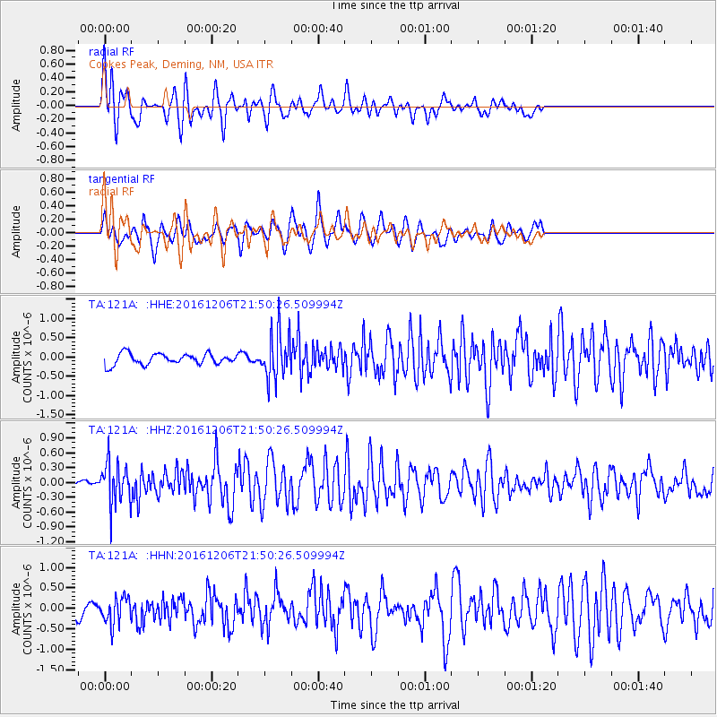
121A Cookes Peak, Deming, NM, USA - Earthquake Result Viewer
*The percent match for this event was below the threshold and hence no stack was calculated.
| Earthquake location: |
Windward Islands |
| Earthquake latitude/longitude: |
11.1/-60.9 |
| Earthquake time(UTC): |
2016/12/06 (341) 21:42:21 GMT |
| Earthquake Depth: |
35 km |
| Earthquake Magnitude: |
5.9 Mww |
| Earthquake Catalog/Contributor: |
NEIC PDE/us |
|
| Network: |
TA USArray Transportable Network (new EarthScope stations) |
| Station: |
121A Cookes Peak, Deming, NM, USA |
| Lat/Lon: |
32.53 N/107.79 W |
| Elevation: |
1652 m |
|
| Distance: |
48.0 deg |
| Az: |
303.958 deg |
| Baz: |
105.445 deg |
| Ray Param: |
$rayparam |
*The percent match for this event was below the threshold and hence was not used in the summary stack. |
|
| Radial Match: |
76.53785 % |
| Radial Bump: |
400 |
| Transverse Match: |
66.592445 % |
| Transverse Bump: |
400 |
| SOD ConfigId: |
11737051 |
| Insert Time: |
2019-04-26 05:32:01.101 +0000 |
| GWidth: |
2.5 |
| Max Bumps: |
400 |
| Tol: |
0.001 |
|
Signal To Noise
| Channel | StoN | STA | LTA |
| TA:121A: :HHZ:20161206T21:50:26.509994Z | 7.5836067 | 4.1507346E-7 | 5.473299E-8 |
| TA:121A: :HHN:20161206T21:50:26.509994Z | 2.252665 | 3.29157E-7 | 1.4611892E-7 |
| TA:121A: :HHE:20161206T21:50:26.509994Z | 4.262165 | 6.0641355E-7 | 1.422783E-7 |
| Arrivals |
| Ps | |
| PpPs | |
| PsPs/PpSs | |


