You are here: Home > Network List > TA - USArray Transportable Network (new EarthScope stations) Stations List
> Station J20K Nowitna River, AK, USA > Earthquake Result Viewer
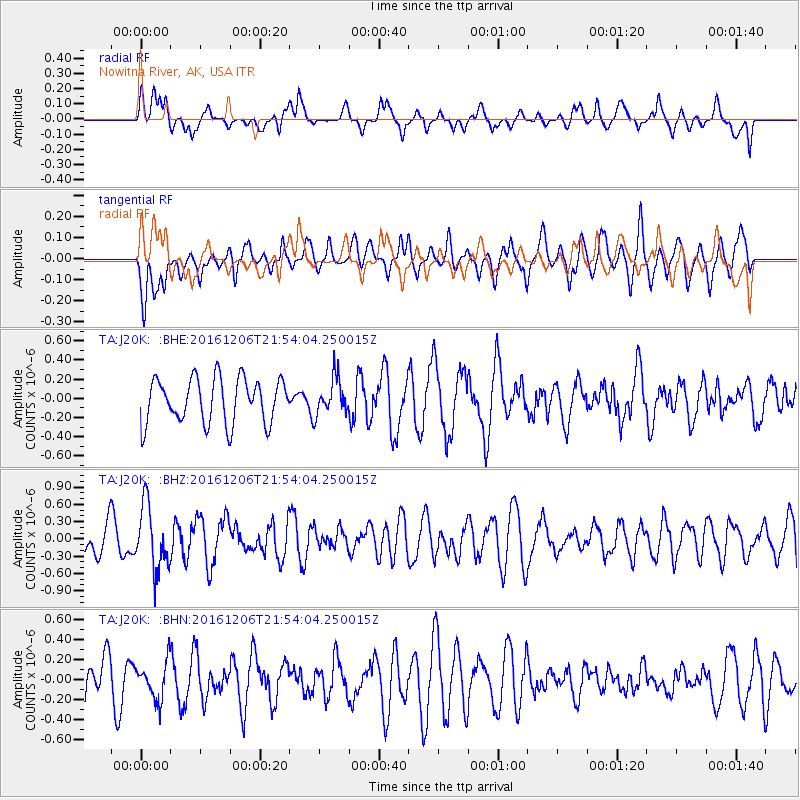
J20K Nowitna River, AK, USA - Earthquake Result Viewer
*The percent match for this event was below the threshold and hence no stack was calculated.
| Earthquake location: |
Windward Islands |
| Earthquake latitude/longitude: |
11.1/-60.9 |
| Earthquake time(UTC): |
2016/12/06 (341) 21:42:21 GMT |
| Earthquake Depth: |
35 km |
| Earthquake Magnitude: |
5.9 Mww |
| Earthquake Catalog/Contributor: |
NEIC PDE/us |
|
| Network: |
TA USArray Transportable Network (new EarthScope stations) |
| Station: |
J20K Nowitna River, AK, USA |
| Lat/Lon: |
64.18 N/154.15 W |
| Elevation: |
314 m |
|
| Distance: |
81.5 deg |
| Az: |
333.763 deg |
| Baz: |
82.246 deg |
| Ray Param: |
$rayparam |
*The percent match for this event was below the threshold and hence was not used in the summary stack. |
|
| Radial Match: |
45.777027 % |
| Radial Bump: |
391 |
| Transverse Match: |
60.79944 % |
| Transverse Bump: |
400 |
| SOD ConfigId: |
11737051 |
| Insert Time: |
2019-04-26 05:32:27.441 +0000 |
| GWidth: |
2.5 |
| Max Bumps: |
400 |
| Tol: |
0.001 |
|
Signal To Noise
| Channel | StoN | STA | LTA |
| TA:J20K: :BHZ:20161206T21:54:04.250015Z | 2.0686681 | 5.5476187E-7 | 2.6817344E-7 |
| TA:J20K: :BHN:20161206T21:54:04.250015Z | 0.79693455 | 1.8804928E-7 | 2.3596579E-7 |
| TA:J20K: :BHE:20161206T21:54:04.250015Z | 0.8068101 | 1.878476E-7 | 2.3282753E-7 |
| Arrivals |
| Ps | |
| PpPs | |
| PsPs/PpSs | |


