You are here: Home > Network List > TA - USArray Transportable Network (new EarthScope stations) Stations List
> Station MSTX Muleshoe, TX, USA > Earthquake Result Viewer
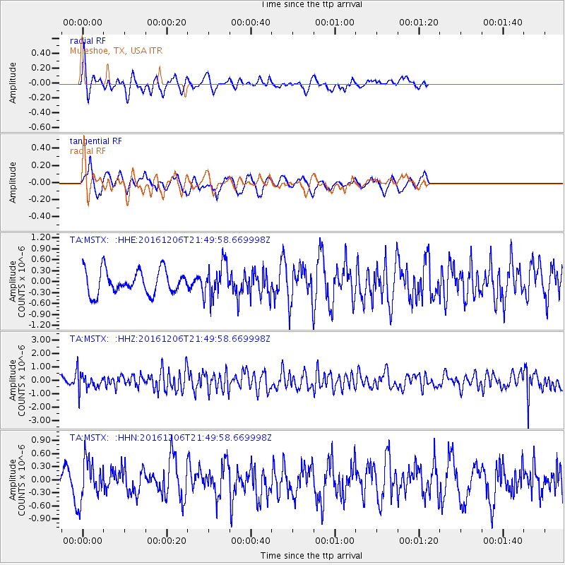
MSTX Muleshoe, TX, USA - Earthquake Result Viewer
*The percent match for this event was below the threshold and hence no stack was calculated.
| Earthquake location: |
Windward Islands |
| Earthquake latitude/longitude: |
11.1/-60.9 |
| Earthquake time(UTC): |
2016/12/06 (341) 21:42:21 GMT |
| Earthquake Depth: |
35 km |
| Earthquake Magnitude: |
5.9 Mww |
| Earthquake Catalog/Contributor: |
NEIC PDE/us |
|
| Network: |
TA USArray Transportable Network (new EarthScope stations) |
| Station: |
MSTX Muleshoe, TX, USA |
| Lat/Lon: |
33.97 N/102.77 W |
| Elevation: |
1167 m |
|
| Distance: |
44.5 deg |
| Az: |
307.649 deg |
| Baz: |
110.736 deg |
| Ray Param: |
$rayparam |
*The percent match for this event was below the threshold and hence was not used in the summary stack. |
|
| Radial Match: |
48.714348 % |
| Radial Bump: |
357 |
| Transverse Match: |
62.247753 % |
| Transverse Bump: |
400 |
| SOD ConfigId: |
11737051 |
| Insert Time: |
2019-04-26 05:32:41.897 +0000 |
| GWidth: |
2.5 |
| Max Bumps: |
400 |
| Tol: |
0.001 |
|
Signal To Noise
| Channel | StoN | STA | LTA |
| TA:MSTX: :HHZ:20161206T21:49:58.669998Z | 2.5508375 | 5.504947E-7 | 2.1580938E-7 |
| TA:MSTX: :HHN:20161206T21:49:58.669998Z | 1.8440908 | 4.4768777E-7 | 2.4276883E-7 |
| TA:MSTX: :HHE:20161206T21:49:58.669998Z | 1.4343389 | 4.6678988E-7 | 3.2543903E-7 |
| Arrivals |
| Ps | |
| PpPs | |
| PsPs/PpSs | |


