You are here: Home > Network List > CI - Caltech Regional Seismic Network Stations List
> Station SDD SDD, Mission Viejo, CA, USA > Earthquake Result Viewer
SDD SDD, Mission Viejo, CA, USA - Earthquake Result Viewer

| Earthquake location: |
New Ireland Region, P.N.G. |
| Earthquake latitude/longitude: |
-4.0/152.2 |
| Earthquake time(UTC): |
2000/11/16 (321) 04:54:56 GMT |
| Earthquake Depth: |
33 km |
| Earthquake Magnitude: |
6.0 MB, 8.2 MS, 8.0 MW, 8.0 ME |
| Earthquake Catalog/Contributor: |
WHDF/NEIC |
|
| Network: |
CI Caltech Regional Seismic Network |
| Station: |
SDD SDD, Mission Viejo, CA, USA |
| Lat/Lon: |
33.55 N/117.66 W |
| Elevation: |
120 m |
|
| Distance: |
92.3 deg |
| Az: |
56.695 deg |
| Baz: |
266.79 deg |
| Ray Param: |
0.04146844 |
| Estimated Moho Depth: |
51.75 km |
| Estimated Crust Vp/Vs: |
2.05 |
| Assumed Crust Vp: |
6.264 km/s |
| Estimated Crust Vs: |
3.059 km/s |
| Estimated Crust Poisson's Ratio: |
0.34 |
|
| Radial Match: |
87.20103 % |
| Radial Bump: |
400 |
| Transverse Match: |
77.570625 % |
| Transverse Bump: |
400 |
| SOD ConfigId: |
3770 |
| Insert Time: |
2010-02-26 00:54:59.356 +0000 |
| GWidth: |
2.5 |
| Max Bumps: |
400 |
| Tol: |
0.001 |
|
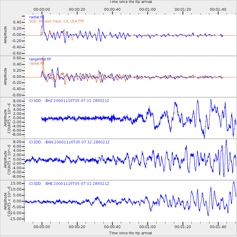
Signal To Noise
| Channel | StoN | STA | LTA |
| CI:SDD: :BHN:20001116T05:07:32.286021Z | 0.6947805 | 4.0124374E-7 | 5.775115E-7 |
| CI:SDD: :BHE:20001116T05:07:32.286021Z | 0.91749156 | 5.7865714E-7 | 6.306948E-7 |
| CI:SDD: :BHZ:20001116T05:07:32.286021Z | 0.97548044 | 5.1793785E-7 | 5.3095664E-7 |
| Arrivals |
| Ps | 8.8 SECOND |
| PpPs | 25 SECOND |
| PsPs/PpSs | 34 SECOND |


