You are here: Home > Network List > WY - Yellowstone Wyoming Seismic Network Stations List
> Station YHH Holmes Hill, YNP, WY, USA > Earthquake Result Viewer
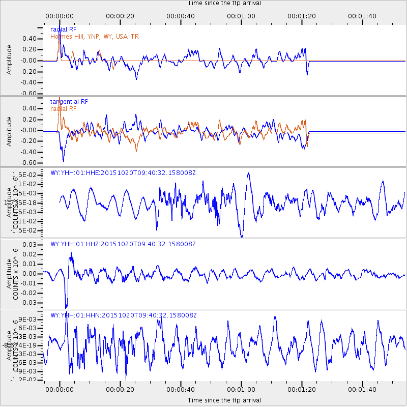
YHH Holmes Hill, YNP, WY, USA - Earthquake Result Viewer
*The percent match for this event was below the threshold and hence no stack was calculated.
| Earthquake location: |
Bonin Islands, Japan Region |
| Earthquake latitude/longitude: |
27.0/140.3 |
| Earthquake time(UTC): |
2015/10/20 (293) 09:29:08 GMT |
| Earthquake Depth: |
300 km |
| Earthquake Magnitude: |
5.5 MB |
| Earthquake Catalog/Contributor: |
NEIC PDE/NEIC COMCAT |
|
| Network: |
WY Yellowstone Wyoming Seismic Network |
| Station: |
YHH Holmes Hill, YNP, WY, USA |
| Lat/Lon: |
44.79 N/110.85 W |
| Elevation: |
2717 m |
|
| Distance: |
83.6 deg |
| Az: |
42.687 deg |
| Baz: |
301.867 deg |
| Ray Param: |
$rayparam |
*The percent match for this event was below the threshold and hence was not used in the summary stack. |
|
| Radial Match: |
74.44784 % |
| Radial Bump: |
400 |
| Transverse Match: |
67.56842 % |
| Transverse Bump: |
400 |
| SOD ConfigId: |
1259291 |
| Insert Time: |
2015-11-03 10:13:25.413 +0000 |
| GWidth: |
2.5 |
| Max Bumps: |
400 |
| Tol: |
0.001 |
|
Signal To Noise
| Channel | StoN | STA | LTA |
| WY:YHH:01:HHZ:20151020T09:40:32.158008Z | 2.7932932 | 1.5456212E-8 | 5.53333E-9 |
| WY:YHH:01:HHN:20151020T09:40:32.158008Z | 1.1582611 | 5.019166E-9 | 4.3333634E-9 |
| WY:YHH:01:HHE:20151020T09:40:32.158008Z | 1.2174538 | 5.3691718E-9 | 4.4101647E-9 |
| Arrivals |
| Ps | |
| PpPs | |
| PsPs/PpSs | |


