You are here: Home > Network List > CI - Caltech Regional Seismic Network Stations List
> Station FUR Furnace Creek, CA, USA > Earthquake Result Viewer
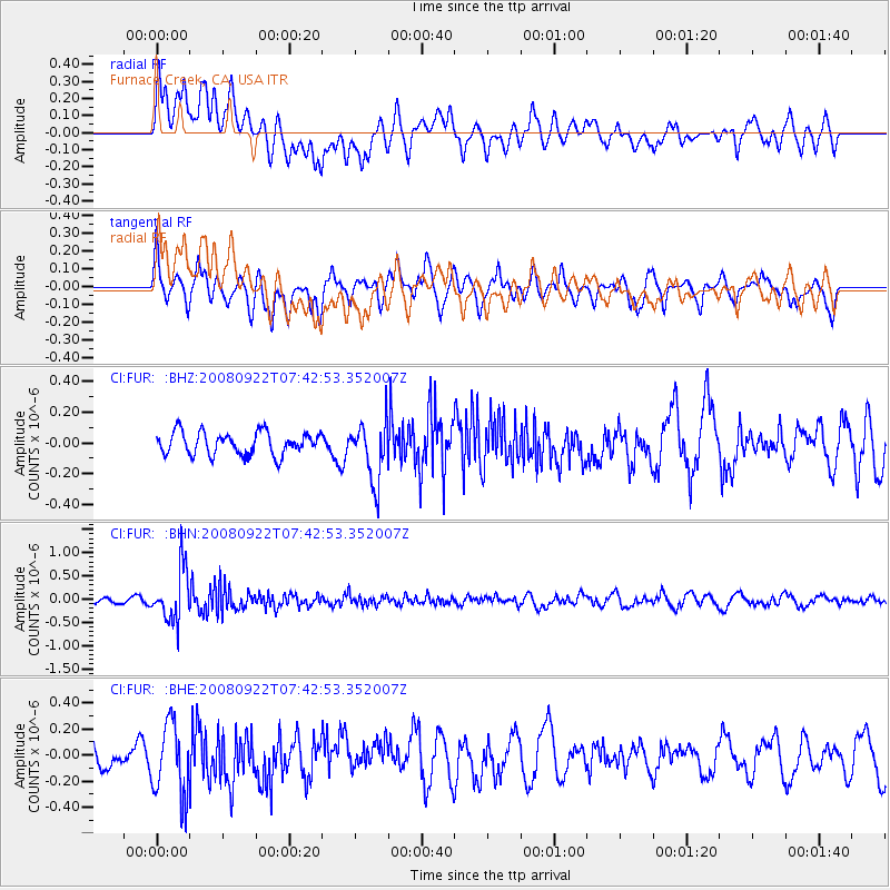
FUR Furnace Creek, CA, USA - Earthquake Result Viewer
*The percent match for this event was below the threshold and hence no stack was calculated.
| Earthquake location: |
Hokkaido, Japan Region |
| Earthquake latitude/longitude: |
41.6/140.4 |
| Earthquake time(UTC): |
2008/09/22 (266) 07:31:59 GMT |
| Earthquake Depth: |
149 km |
| Earthquake Magnitude: |
5.7 MW, 5.3 MB, 5.6 MW |
| Earthquake Catalog/Contributor: |
WHDF/NEIC |
|
| Network: |
CI Caltech Regional Seismic Network |
| Station: |
FUR Furnace Creek, CA, USA |
| Lat/Lon: |
36.47 N/116.86 W |
| Elevation: |
-37.0 m |
|
| Distance: |
75.0 deg |
| Az: |
54.496 deg |
| Baz: |
310.74 deg |
| Ray Param: |
$rayparam |
*The percent match for this event was below the threshold and hence was not used in the summary stack. |
|
| Radial Match: |
61.834114 % |
| Radial Bump: |
400 |
| Transverse Match: |
67.0323 % |
| Transverse Bump: |
400 |
| SOD ConfigId: |
2560 |
| Insert Time: |
2010-03-05 20:16:25.669 +0000 |
| GWidth: |
2.5 |
| Max Bumps: |
400 |
| Tol: |
0.001 |
|
Signal To Noise
| Channel | StoN | STA | LTA |
| CI:FUR: :BHN:20080922T07:42:53.352007Z | 7.0287337 | 5.5419355E-7 | 7.884686E-8 |
| CI:FUR: :BHE:20080922T07:42:53.352007Z | 3.4875295 | 2.7809043E-7 | 7.973851E-8 |
| CI:FUR: :BHZ:20080922T07:42:53.352007Z | 2.6072326 | 1.9287378E-7 | 7.3976445E-8 |
| Arrivals |
| Ps | |
| PpPs | |
| PsPs/PpSs | |


