You are here: Home > Network List > CI - Caltech Regional Seismic Network Stations List
> Station FUR Furnace Creek, CA, USA > Earthquake Result Viewer
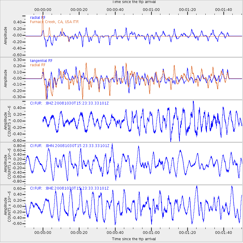
FUR Furnace Creek, CA, USA - Earthquake Result Viewer
*The percent match for this event was below the threshold and hence no stack was calculated.
| Earthquake location: |
Central East Pacific Rise |
| Earthquake latitude/longitude: |
-9.0/-108.2 |
| Earthquake time(UTC): |
2008/10/30 (304) 15:15:41 GMT |
| Earthquake Depth: |
10 km |
| Earthquake Magnitude: |
5.5 MB, 5.8 MS, 6.0 MW, 6.0 MW |
| Earthquake Catalog/Contributor: |
WHDF/NEIC |
|
| Network: |
CI Caltech Regional Seismic Network |
| Station: |
FUR Furnace Creek, CA, USA |
| Lat/Lon: |
36.47 N/116.86 W |
| Elevation: |
-37.0 m |
|
| Distance: |
46.0 deg |
| Az: |
350.328 deg |
| Baz: |
168.119 deg |
| Ray Param: |
$rayparam |
*The percent match for this event was below the threshold and hence was not used in the summary stack. |
|
| Radial Match: |
71.27938 % |
| Radial Bump: |
400 |
| Transverse Match: |
62.797268 % |
| Transverse Bump: |
400 |
| SOD ConfigId: |
2560 |
| Insert Time: |
2010-03-05 20:16:28.106 +0000 |
| GWidth: |
2.5 |
| Max Bumps: |
400 |
| Tol: |
0.001 |
|
Signal To Noise
| Channel | StoN | STA | LTA |
| CI:FUR: :BHN:20081030T15:23:33.33101Z | 2.3097398 | 3.564726E-7 | 1.5433453E-7 |
| CI:FUR: :BHE:20081030T15:23:33.33101Z | 1.0821764 | 1.9543225E-7 | 1.8059184E-7 |
| CI:FUR: :BHZ:20081030T15:23:33.33101Z | 0.8116854 | 1.2495033E-7 | 1.5393937E-7 |
| Arrivals |
| Ps | |
| PpPs | |
| PsPs/PpSs | |


