You are here: Home > Network List > CI - Caltech Regional Seismic Network Stations List
> Station FUR Furnace Creek, CA, USA > Earthquake Result Viewer
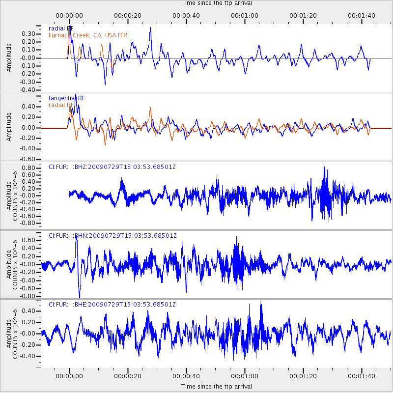
FUR Furnace Creek, CA, USA - Earthquake Result Viewer
*The percent match for this event was below the threshold and hence no stack was calculated.
| Earthquake location: |
Volcano Islands, Japan Region |
| Earthquake latitude/longitude: |
22.6/143.3 |
| Earthquake time(UTC): |
2009/07/29 (210) 14:52:08 GMT |
| Earthquake Depth: |
140 km |
| Earthquake Magnitude: |
5.5 MW, 5.2 MB, 5.4 MW |
| Earthquake Catalog/Contributor: |
WHDF/NEIC |
|
| Network: |
CI Caltech Regional Seismic Network |
| Station: |
FUR Furnace Creek, CA, USA |
| Lat/Lon: |
36.47 N/116.86 W |
| Elevation: |
-37.0 m |
|
| Distance: |
84.4 deg |
| Az: |
52.94 deg |
| Baz: |
293.79 deg |
| Ray Param: |
$rayparam |
*The percent match for this event was below the threshold and hence was not used in the summary stack. |
|
| Radial Match: |
65.346176 % |
| Radial Bump: |
400 |
| Transverse Match: |
55.108315 % |
| Transverse Bump: |
400 |
| SOD ConfigId: |
2622 |
| Insert Time: |
2010-03-05 20:17:04.660 +0000 |
| GWidth: |
2.5 |
| Max Bumps: |
400 |
| Tol: |
0.001 |
|
Signal To Noise
| Channel | StoN | STA | LTA |
| CI:FUR: :BHN:20090729T15:03:53.68501Z | 5.183997 | 3.414128E-7 | 6.5858984E-8 |
| CI:FUR: :BHE:20090729T15:03:53.68501Z | 1.6942985 | 1.780473E-7 | 1.05086144E-7 |
| CI:FUR: :BHZ:20090729T15:03:53.68501Z | 1.0681293 | 1.3665559E-7 | 1.2793919E-7 |
| Arrivals |
| Ps | |
| PpPs | |
| PsPs/PpSs | |


