You are here: Home > Network List > CI - Caltech Regional Seismic Network Stations List
> Station FUR Furnace Creek, CA, USA > Earthquake Result Viewer
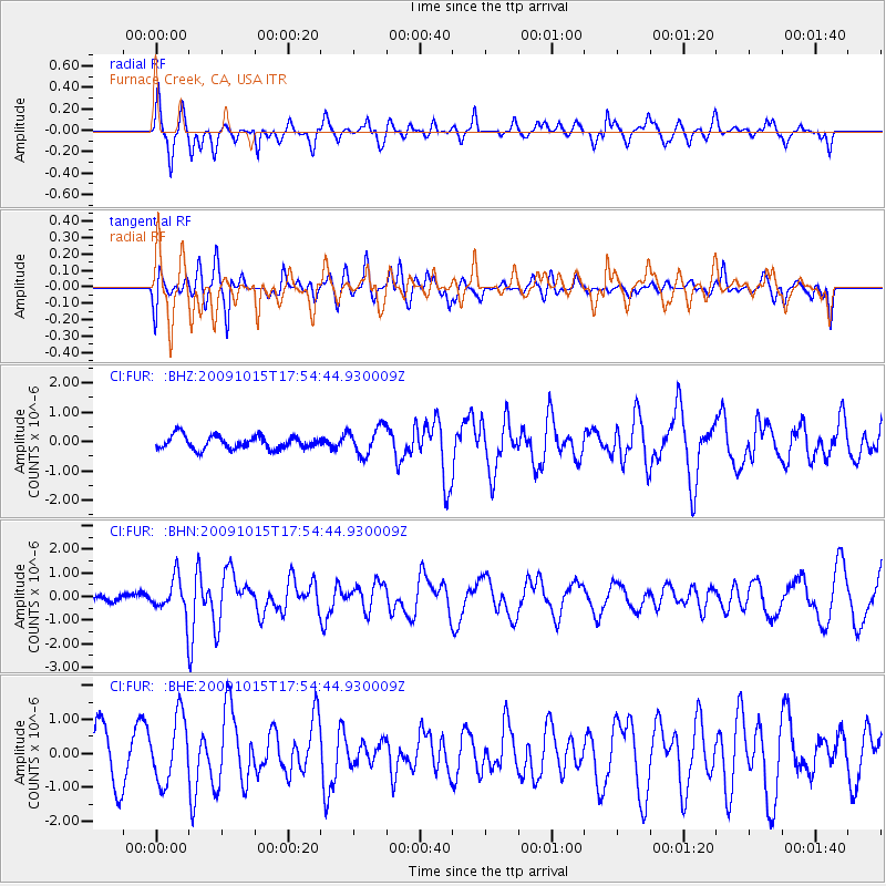
FUR Furnace Creek, CA, USA - Earthquake Result Viewer
*The percent match for this event was below the threshold and hence no stack was calculated.
| Earthquake location: |
Galapagos Triple Junction Region |
| Earthquake latitude/longitude: |
3.3/-103.8 |
| Earthquake time(UTC): |
2009/10/15 (288) 17:48:21 GMT |
| Earthquake Depth: |
10 km |
| Earthquake Magnitude: |
5.9 MB, 5.7 MS, 6.0 MW, 6.0 MW |
| Earthquake Catalog/Contributor: |
WHDF/NEIC |
|
| Network: |
CI Caltech Regional Seismic Network |
| Station: |
FUR Furnace Creek, CA, USA |
| Lat/Lon: |
36.47 N/116.86 W |
| Elevation: |
-37.0 m |
|
| Distance: |
35.2 deg |
| Az: |
341.585 deg |
| Baz: |
156.968 deg |
| Ray Param: |
$rayparam |
*The percent match for this event was below the threshold and hence was not used in the summary stack. |
|
| Radial Match: |
67.098724 % |
| Radial Bump: |
375 |
| Transverse Match: |
43.70933 % |
| Transverse Bump: |
400 |
| SOD ConfigId: |
2622 |
| Insert Time: |
2010-03-05 20:17:12.835 +0000 |
| GWidth: |
2.5 |
| Max Bumps: |
400 |
| Tol: |
0.001 |
|
Signal To Noise
| Channel | StoN | STA | LTA |
| CI:FUR: :BHN:20091015T17:54:44.930009Z | 2.8627107 | 7.7638305E-7 | 2.7120555E-7 |
| CI:FUR: :BHE:20091015T17:54:44.930009Z | 1.6997235 | 9.546858E-7 | 5.6167124E-7 |
| CI:FUR: :BHZ:20091015T17:54:44.930009Z | 2.092136 | 4.7188777E-7 | 2.2555311E-7 |
| Arrivals |
| Ps | |
| PpPs | |
| PsPs/PpSs | |


