You are here: Home > Network List > CI - Caltech Regional Seismic Network Stations List
> Station FUR Furnace Creek, CA, USA > Earthquake Result Viewer
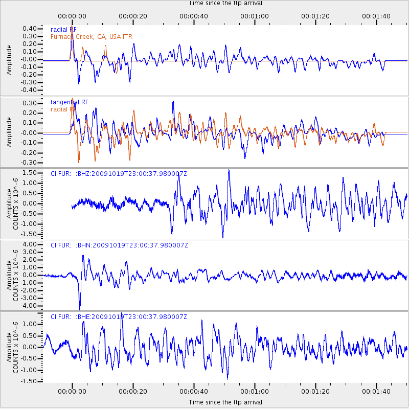
FUR Furnace Creek, CA, USA - Earthquake Result Viewer
*The percent match for this event was below the threshold and hence no stack was calculated.
| Earthquake location: |
Samoa Islands Region |
| Earthquake latitude/longitude: |
-15.4/-172.3 |
| Earthquake time(UTC): |
2009/10/19 (292) 22:49:38 GMT |
| Earthquake Depth: |
18 km |
| Earthquake Magnitude: |
6.2 MB, 5.7 MS, 6.0 MW, 5.9 MW |
| Earthquake Catalog/Contributor: |
WHDF/NEIC |
|
| Network: |
CI Caltech Regional Seismic Network |
| Station: |
FUR Furnace Creek, CA, USA |
| Lat/Lon: |
36.47 N/116.86 W |
| Elevation: |
-37.0 m |
|
| Distance: |
73.4 deg |
| Az: |
43.822 deg |
| Baz: |
235.964 deg |
| Ray Param: |
$rayparam |
*The percent match for this event was below the threshold and hence was not used in the summary stack. |
|
| Radial Match: |
82.434555 % |
| Radial Bump: |
400 |
| Transverse Match: |
79.004234 % |
| Transverse Bump: |
400 |
| SOD ConfigId: |
2622 |
| Insert Time: |
2010-03-05 20:17:14.708 +0000 |
| GWidth: |
2.5 |
| Max Bumps: |
400 |
| Tol: |
0.001 |
|
Signal To Noise
| Channel | StoN | STA | LTA |
| CI:FUR: :BHN:20091019T23:00:37.980007Z | 10.24361 | 1.5181312E-6 | 1.4820274E-7 |
| CI:FUR: :BHE:20091019T23:00:37.980007Z | 2.1844213 | 4.7872334E-7 | 2.1915339E-7 |
| CI:FUR: :BHZ:20091019T23:00:37.980007Z | 3.540269 | 5.5766566E-7 | 1.575207E-7 |
| Arrivals |
| Ps | |
| PpPs | |
| PsPs/PpSs | |


