You are here: Home > Network List > CI - Caltech Regional Seismic Network Stations List
> Station FUR Furnace Creek, CA, USA > Earthquake Result Viewer
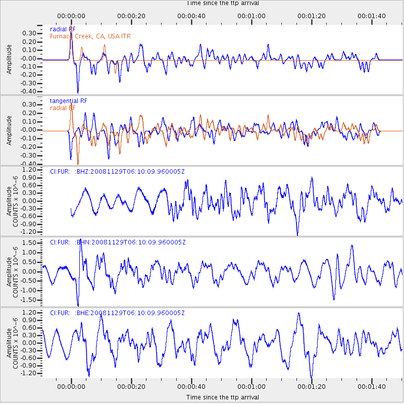
FUR Furnace Creek, CA, USA - Earthquake Result Viewer
*The percent match for this event was below the threshold and hence no stack was calculated.
| Earthquake location: |
Fiji Islands Region |
| Earthquake latitude/longitude: |
-18.7/-177.7 |
| Earthquake time(UTC): |
2008/11/29 (334) 05:59:16 GMT |
| Earthquake Depth: |
386 km |
| Earthquake Magnitude: |
5.7 MB, 6.0 MW, 5.9 MW |
| Earthquake Catalog/Contributor: |
WHDF/NEIC |
|
| Network: |
CI Caltech Regional Seismic Network |
| Station: |
FUR Furnace Creek, CA, USA |
| Lat/Lon: |
36.47 N/116.86 W |
| Elevation: |
-37.0 m |
|
| Distance: |
79.4 deg |
| Az: |
45.741 deg |
| Baz: |
237.366 deg |
| Ray Param: |
$rayparam |
*The percent match for this event was below the threshold and hence was not used in the summary stack. |
|
| Radial Match: |
59.410213 % |
| Radial Bump: |
400 |
| Transverse Match: |
40.863197 % |
| Transverse Bump: |
400 |
| SOD ConfigId: |
2658 |
| Insert Time: |
2010-03-05 20:17:26.430 +0000 |
| GWidth: |
2.5 |
| Max Bumps: |
400 |
| Tol: |
0.001 |
|
Signal To Noise
| Channel | StoN | STA | LTA |
| CI:FUR: :BHN:20081129T06:10:09.960005Z | 4.392944 | 8.5452143E-7 | 1.9452136E-7 |
| CI:FUR: :BHE:20081129T06:10:09.960005Z | 1.4664601 | 4.2527375E-7 | 2.900002E-7 |
| CI:FUR: :BHZ:20081129T06:10:09.960005Z | 1.3506614 | 3.9162663E-7 | 2.8995177E-7 |
| Arrivals |
| Ps | |
| PpPs | |
| PsPs/PpSs | |


