You are here: Home > Network List > CI - Caltech Regional Seismic Network Stations List
> Station FUR Furnace Creek, CA, USA > Earthquake Result Viewer
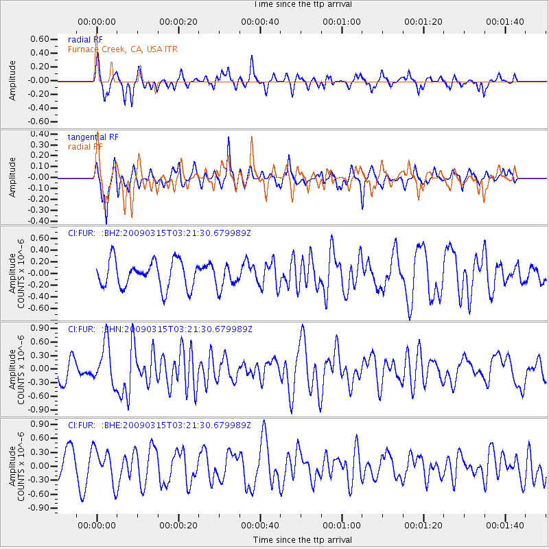
FUR Furnace Creek, CA, USA - Earthquake Result Viewer
*The percent match for this event was below the threshold and hence no stack was calculated.
| Earthquake location: |
Galapagos Islands Region |
| Earthquake latitude/longitude: |
2.4/-95.1 |
| Earthquake time(UTC): |
2009/03/15 (074) 03:14:31 GMT |
| Earthquake Depth: |
10 km |
| Earthquake Magnitude: |
5.5 MS, 5.4 MB, 5.8 MW, 5.8 MW |
| Earthquake Catalog/Contributor: |
WHDF/NEIC |
|
| Network: |
CI Caltech Regional Seismic Network |
| Station: |
FUR Furnace Creek, CA, USA |
| Lat/Lon: |
36.47 N/116.86 W |
| Elevation: |
-37.0 m |
|
| Distance: |
39.4 deg |
| Az: |
331.924 deg |
| Baz: |
144.315 deg |
| Ray Param: |
$rayparam |
*The percent match for this event was below the threshold and hence was not used in the summary stack. |
|
| Radial Match: |
63.249874 % |
| Radial Bump: |
345 |
| Transverse Match: |
70.94889 % |
| Transverse Bump: |
372 |
| SOD ConfigId: |
2658 |
| Insert Time: |
2010-03-05 20:17:32.362 +0000 |
| GWidth: |
2.5 |
| Max Bumps: |
400 |
| Tol: |
0.001 |
|
Signal To Noise
| Channel | StoN | STA | LTA |
| CI:FUR: :BHN:20090315T03:21:30.679989Z | 2.7255754 | 4.6937413E-7 | 1.7221102E-7 |
| CI:FUR: :BHE:20090315T03:21:30.679989Z | 1.4127629 | 3.5890685E-7 | 2.5404606E-7 |
| CI:FUR: :BHZ:20090315T03:21:30.679989Z | 0.8603773 | 1.9850268E-7 | 2.3071584E-7 |
| Arrivals |
| Ps | |
| PpPs | |
| PsPs/PpSs | |


