You are here: Home > Network List > CI - Caltech Regional Seismic Network Stations List
> Station FUR Furnace Creek, CA, USA > Earthquake Result Viewer
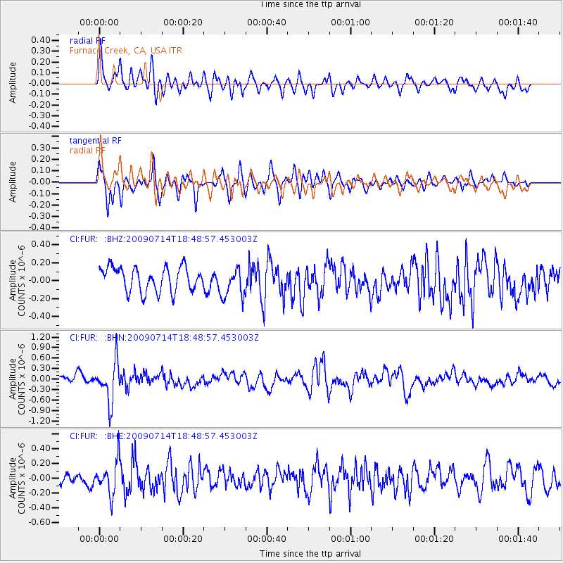
FUR Furnace Creek, CA, USA - Earthquake Result Viewer
*The percent match for this event was below the threshold and hence no stack was calculated.
| Earthquake location: |
Chile-Bolivia Border Region |
| Earthquake latitude/longitude: |
-21.8/-67.1 |
| Earthquake time(UTC): |
2009/07/14 (195) 18:38:08 GMT |
| Earthquake Depth: |
176 km |
| Earthquake Magnitude: |
5.7 MW, 5.4 MB, 5.7 MW |
| Earthquake Catalog/Contributor: |
WHDF/NEIC |
|
| Network: |
CI Caltech Regional Seismic Network |
| Station: |
FUR Furnace Creek, CA, USA |
| Lat/Lon: |
36.47 N/116.86 W |
| Elevation: |
-37.0 m |
|
| Distance: |
74.6 deg |
| Az: |
320.335 deg |
| Baz: |
132.627 deg |
| Ray Param: |
$rayparam |
*The percent match for this event was below the threshold and hence was not used in the summary stack. |
|
| Radial Match: |
66.52639 % |
| Radial Bump: |
400 |
| Transverse Match: |
72.34634 % |
| Transverse Bump: |
400 |
| SOD ConfigId: |
2648 |
| Insert Time: |
2010-03-05 20:17:41.952 +0000 |
| GWidth: |
2.5 |
| Max Bumps: |
400 |
| Tol: |
0.001 |
|
Signal To Noise
| Channel | StoN | STA | LTA |
| CI:FUR: :BHN:20090714T18:48:57.453003Z | 5.0782876 | 5.8044014E-7 | 1.142984E-7 |
| CI:FUR: :BHE:20090714T18:48:57.453003Z | 3.2941215 | 2.2581985E-7 | 6.8552374E-8 |
| CI:FUR: :BHZ:20090714T18:48:57.453003Z | 1.2490153 | 1.6908903E-7 | 1.3537786E-7 |
| Arrivals |
| Ps | |
| PpPs | |
| PsPs/PpSs | |


