You are here: Home > Network List > CI - Caltech Regional Seismic Network Stations List
> Station FUR Furnace Creek, CA, USA > Earthquake Result Viewer
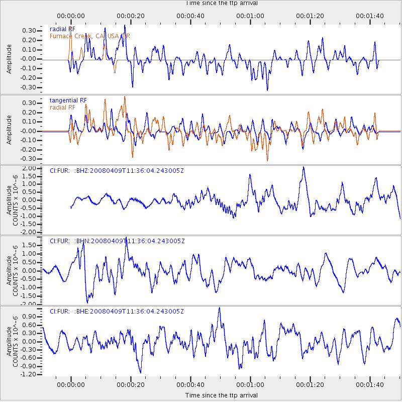
FUR Furnace Creek, CA, USA - Earthquake Result Viewer
*The percent match for this event was below the threshold and hence no stack was calculated.
| Earthquake location: |
Loyalty Islands |
| Earthquake latitude/longitude: |
-20.2/168.9 |
| Earthquake time(UTC): |
2008/04/09 (100) 11:23:40 GMT |
| Earthquake Depth: |
35 km |
| Earthquake Magnitude: |
5.7 MB, 6.3 MW, 6.3 MW |
| Earthquake Catalog/Contributor: |
WHDF/NEIC |
|
| Network: |
CI Caltech Regional Seismic Network |
| Station: |
FUR Furnace Creek, CA, USA |
| Lat/Lon: |
36.47 N/116.86 W |
| Elevation: |
-37.0 m |
|
| Distance: |
89.8 deg |
| Az: |
50.875 deg |
| Baz: |
244.687 deg |
| Ray Param: |
$rayparam |
*The percent match for this event was below the threshold and hence was not used in the summary stack. |
|
| Radial Match: |
64.563515 % |
| Radial Bump: |
400 |
| Transverse Match: |
53.754185 % |
| Transverse Bump: |
400 |
| SOD ConfigId: |
2504 |
| Insert Time: |
2010-03-05 20:17:56.130 +0000 |
| GWidth: |
2.5 |
| Max Bumps: |
400 |
| Tol: |
0.001 |
|
Signal To Noise
| Channel | StoN | STA | LTA |
| CI:FUR: :BHN:20080409T11:36:04.243005Z | 3.8573663 | 8.4820147E-7 | 2.1989135E-7 |
| CI:FUR: :BHE:20080409T11:36:04.243005Z | 0.7924152 | 1.8269135E-7 | 2.3055003E-7 |
| CI:FUR: :BHZ:20080409T11:36:04.243005Z | 0.84023684 | 1.8095974E-7 | 2.1536754E-7 |
| Arrivals |
| Ps | |
| PpPs | |
| PsPs/PpSs | |


