You are here: Home > Network List > CI - Caltech Regional Seismic Network Stations List
> Station FUR Furnace Creek, CA, USA > Earthquake Result Viewer
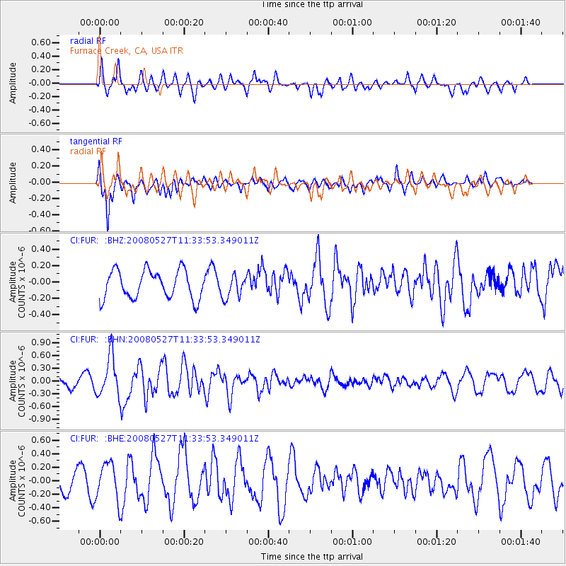
FUR Furnace Creek, CA, USA - Earthquake Result Viewer
*The percent match for this event was below the threshold and hence no stack was calculated.
| Earthquake location: |
Near Coast Of Guatemala |
| Earthquake latitude/longitude: |
13.6/-91.0 |
| Earthquake time(UTC): |
2008/05/27 (148) 11:27:55 GMT |
| Earthquake Depth: |
26 km |
| Earthquake Magnitude: |
5.7 MW, 5.1 MS, 5.3 MB, 5.6 MW |
| Earthquake Catalog/Contributor: |
WHDF/NEIC |
|
| Network: |
CI Caltech Regional Seismic Network |
| Station: |
FUR Furnace Creek, CA, USA |
| Lat/Lon: |
36.47 N/116.86 W |
| Elevation: |
-37.0 m |
|
| Distance: |
32.5 deg |
| Az: |
319.1 deg |
| Baz: |
127.843 deg |
| Ray Param: |
$rayparam |
*The percent match for this event was below the threshold and hence was not used in the summary stack. |
|
| Radial Match: |
74.68265 % |
| Radial Bump: |
400 |
| Transverse Match: |
72.4077 % |
| Transverse Bump: |
400 |
| SOD ConfigId: |
2504 |
| Insert Time: |
2010-03-05 20:18:01.296 +0000 |
| GWidth: |
2.5 |
| Max Bumps: |
400 |
| Tol: |
0.001 |
|
Signal To Noise
| Channel | StoN | STA | LTA |
| CI:FUR: :BHN:20080527T11:33:53.349011Z | 3.0743911 | 4.8323835E-7 | 1.571818E-7 |
| CI:FUR: :BHE:20080527T11:33:53.349011Z | 2.1634974 | 2.7632234E-7 | 1.277202E-7 |
| CI:FUR: :BHZ:20080527T11:33:53.349011Z | 0.8044636 | 1.3781091E-7 | 1.7130783E-7 |
| Arrivals |
| Ps | |
| PpPs | |
| PsPs/PpSs | |


