You are here: Home > Network List > UW - Pacific Northwest Regional Seismic Network Stations List
> Station MRBL Marblemount, WA, USA > Earthquake Result Viewer
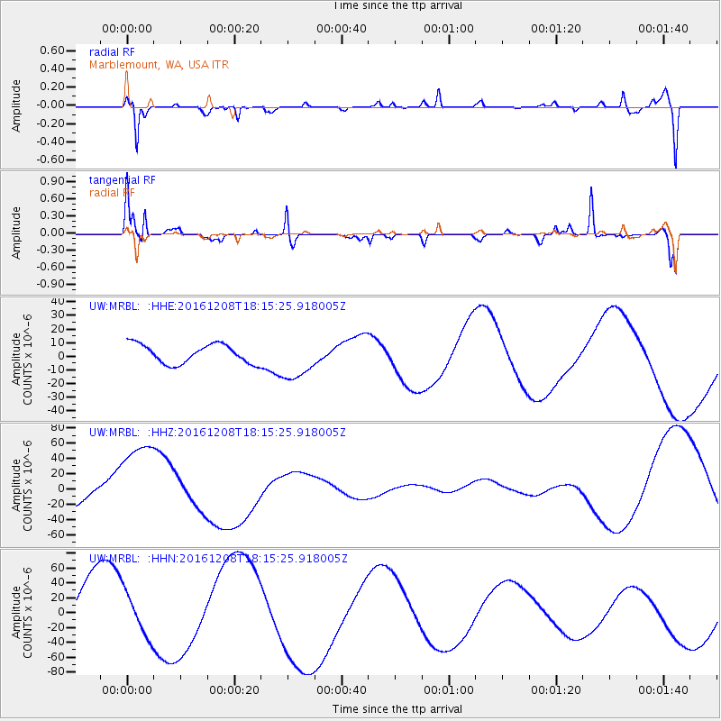
MRBL Marblemount, WA, USA - Earthquake Result Viewer
*The percent match for this event was below the threshold and hence no stack was calculated.
| Earthquake location: |
Solomon Islands |
| Earthquake latitude/longitude: |
-10.4/161.3 |
| Earthquake time(UTC): |
2016/12/08 (343) 18:03:05 GMT |
| Earthquake Depth: |
42 km |
| Earthquake Magnitude: |
5.6 mb |
| Earthquake Catalog/Contributor: |
NEIC PDE/us |
|
| Network: |
UW Pacific Northwest Regional Seismic Network |
| Station: |
MRBL Marblemount, WA, USA |
| Lat/Lon: |
48.52 N/121.48 W |
| Elevation: |
75 m |
|
| Distance: |
89.3 deg |
| Az: |
40.419 deg |
| Baz: |
253.626 deg |
| Ray Param: |
$rayparam |
*The percent match for this event was below the threshold and hence was not used in the summary stack. |
|
| Radial Match: |
59.97334 % |
| Radial Bump: |
400 |
| Transverse Match: |
85.64593 % |
| Transverse Bump: |
380 |
| SOD ConfigId: |
11737051 |
| Insert Time: |
2019-04-26 06:14:39.549 +0000 |
| GWidth: |
2.5 |
| Max Bumps: |
400 |
| Tol: |
0.001 |
|
Signal To Noise
| Channel | StoN | STA | LTA |
| UW:MRBL: :HHZ:20161208T18:15:25.918005Z | 3.0275183 | 6.155804E-5 | 2.033284E-5 |
| UW:MRBL: :HHN:20161208T18:15:25.918005Z | 0.9159426 | 2.8620114E-5 | 3.1246625E-5 |
| UW:MRBL: :HHE:20161208T18:15:25.918005Z | 2.265661 | 1.5839725E-5 | 6.991216E-6 |
| Arrivals |
| Ps | |
| PpPs | |
| PsPs/PpSs | |


