You are here: Home > Network List > UW - Pacific Northwest Regional Seismic Network Stations List
> Station UMAT Pilot Rock, OR, USA > Earthquake Result Viewer
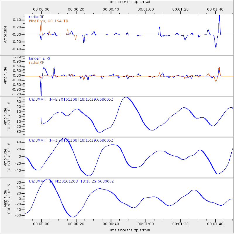
UMAT Pilot Rock, OR, USA - Earthquake Result Viewer
*The percent match for this event was below the threshold and hence no stack was calculated.
| Earthquake location: |
Solomon Islands |
| Earthquake latitude/longitude: |
-10.4/161.3 |
| Earthquake time(UTC): |
2016/12/08 (343) 18:03:05 GMT |
| Earthquake Depth: |
42 km |
| Earthquake Magnitude: |
5.6 mb |
| Earthquake Catalog/Contributor: |
NEIC PDE/us |
|
| Network: |
UW Pacific Northwest Regional Seismic Network |
| Station: |
UMAT Pilot Rock, OR, USA |
| Lat/Lon: |
45.29 N/118.96 W |
| Elevation: |
1318 m |
|
| Distance: |
90.2 deg |
| Az: |
43.992 deg |
| Baz: |
255.48 deg |
| Ray Param: |
$rayparam |
*The percent match for this event was below the threshold and hence was not used in the summary stack. |
|
| Radial Match: |
59.803093 % |
| Radial Bump: |
400 |
| Transverse Match: |
47.294556 % |
| Transverse Bump: |
400 |
| SOD ConfigId: |
11737051 |
| Insert Time: |
2019-04-26 06:14:43.456 +0000 |
| GWidth: |
2.5 |
| Max Bumps: |
400 |
| Tol: |
0.001 |
|
Signal To Noise
| Channel | StoN | STA | LTA |
| UW:UMAT: :HHZ:20161208T18:15:29.668005Z | 2.5568085 | 2.2486642E-5 | 8.794809E-6 |
| UW:UMAT: :HHN:20161208T18:15:29.668005Z | 2.1386974 | 7.6705706E-5 | 3.5865618E-5 |
| UW:UMAT: :HHE:20161208T18:15:29.668005Z | 3.297464 | 2.876696E-5 | 8.723965E-6 |
| Arrivals |
| Ps | |
| PpPs | |
| PsPs/PpSs | |


