You are here: Home > Network List > TA - USArray Transportable Network (new EarthScope stations) Stations List
> Station D25K Kavik River, AK, USA > Earthquake Result Viewer
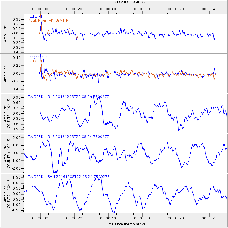
D25K Kavik River, AK, USA - Earthquake Result Viewer
*The percent match for this event was below the threshold and hence no stack was calculated.
| Earthquake location: |
Solomon Islands |
| Earthquake latitude/longitude: |
-10.8/161.3 |
| Earthquake time(UTC): |
2016/12/08 (343) 21:56:07 GMT |
| Earthquake Depth: |
15 km |
| Earthquake Magnitude: |
6.5 Mww |
| Earthquake Catalog/Contributor: |
NEIC PDE/us |
|
| Network: |
TA USArray Transportable Network (new EarthScope stations) |
| Station: |
D25K Kavik River, AK, USA |
| Lat/Lon: |
69.32 N/146.38 W |
| Elevation: |
770 m |
|
| Distance: |
87.8 deg |
| Az: |
16.34 deg |
| Baz: |
231.089 deg |
| Ray Param: |
$rayparam |
*The percent match for this event was below the threshold and hence was not used in the summary stack. |
|
| Radial Match: |
65.03329 % |
| Radial Bump: |
400 |
| Transverse Match: |
65.496544 % |
| Transverse Bump: |
379 |
| SOD ConfigId: |
11737051 |
| Insert Time: |
2019-04-26 06:34:01.552 +0000 |
| GWidth: |
2.5 |
| Max Bumps: |
400 |
| Tol: |
0.001 |
|
Signal To Noise
| Channel | StoN | STA | LTA |
| TA:D25K: :BHZ:20161208T22:08:24.750027Z | 3.2314014 | 1.1512592E-6 | 3.5627244E-7 |
| TA:D25K: :BHN:20161208T22:08:24.750027Z | 1.6502697 | 5.026975E-7 | 3.0461536E-7 |
| TA:D25K: :BHE:20161208T22:08:24.750027Z | 2.536147 | 8.1341807E-7 | 3.2072984E-7 |
| Arrivals |
| Ps | |
| PpPs | |
| PsPs/PpSs | |


