You are here: Home > Network List > G - GEOSCOPE Stations List
> Station MPG Montagne des Peres, French Guyana > Earthquake Result Viewer
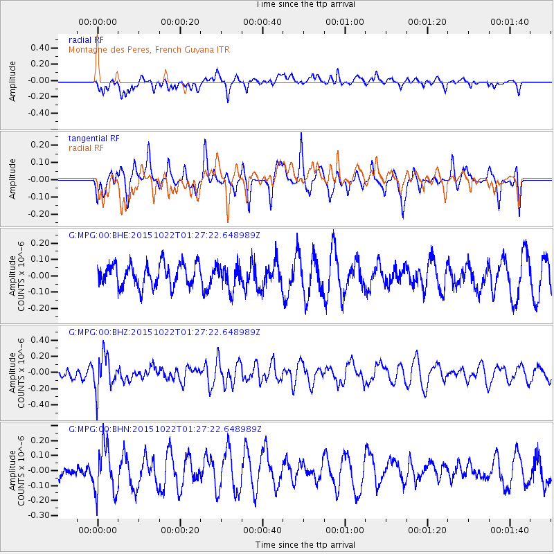
MPG Montagne des Peres, French Guyana - Earthquake Result Viewer
*The percent match for this event was below the threshold and hence no stack was calculated.
| Earthquake location: |
Scotia Sea |
| Earthquake latitude/longitude: |
-60.3/-45.4 |
| Earthquake time(UTC): |
2015/10/22 (295) 01:17:11 GMT |
| Earthquake Depth: |
15 km |
| Earthquake Magnitude: |
5.5 MB |
| Earthquake Catalog/Contributor: |
NEIC PDE/NEIC COMCAT |
|
| Network: |
G GEOSCOPE |
| Station: |
MPG Montagne des Peres, French Guyana |
| Lat/Lon: |
5.11 N/52.64 W |
| Elevation: |
147 m |
|
| Distance: |
65.5 deg |
| Az: |
352.066 deg |
| Baz: |
176.048 deg |
| Ray Param: |
$rayparam |
*The percent match for this event was below the threshold and hence was not used in the summary stack. |
|
| Radial Match: |
40.289852 % |
| Radial Bump: |
400 |
| Transverse Match: |
58.13699 % |
| Transverse Bump: |
400 |
| SOD ConfigId: |
1259291 |
| Insert Time: |
2015-11-05 01:59:49.092 +0000 |
| GWidth: |
2.5 |
| Max Bumps: |
400 |
| Tol: |
0.001 |
|
Signal To Noise
| Channel | StoN | STA | LTA |
| G:MPG:00:BHZ:20151022T01:27:22.648989Z | 2.574968 | 2.1811472E-7 | 8.4705796E-8 |
| G:MPG:00:BHN:20151022T01:27:22.648989Z | 3.0945017 | 1.6207736E-7 | 5.2375913E-8 |
| G:MPG:00:BHE:20151022T01:27:22.648989Z | 1.1006202 | 7.632674E-8 | 6.934885E-8 |
| Arrivals |
| Ps | |
| PpPs | |
| PsPs/PpSs | |


