You are here: Home > Network List > UW - Pacific Northwest Regional Seismic Network Stations List
> Station LCCR Mulino, OR, USA > Earthquake Result Viewer
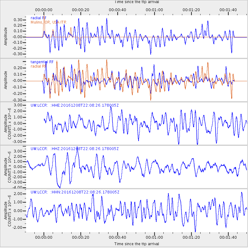
LCCR Mulino, OR, USA - Earthquake Result Viewer
*The percent match for this event was below the threshold and hence no stack was calculated.
| Earthquake location: |
Solomon Islands |
| Earthquake latitude/longitude: |
-10.8/161.3 |
| Earthquake time(UTC): |
2016/12/08 (343) 21:56:07 GMT |
| Earthquake Depth: |
15 km |
| Earthquake Magnitude: |
6.5 Mww |
| Earthquake Catalog/Contributor: |
NEIC PDE/us |
|
| Network: |
UW Pacific Northwest Regional Seismic Network |
| Station: |
LCCR Mulino, OR, USA |
| Lat/Lon: |
45.21 N/122.48 W |
| Elevation: |
273 m |
|
| Distance: |
88.1 deg |
| Az: |
43.391 deg |
| Baz: |
252.684 deg |
| Ray Param: |
$rayparam |
*The percent match for this event was below the threshold and hence was not used in the summary stack. |
|
| Radial Match: |
61.23316 % |
| Radial Bump: |
400 |
| Transverse Match: |
61.884674 % |
| Transverse Bump: |
400 |
| SOD ConfigId: |
11737051 |
| Insert Time: |
2019-04-26 06:34:58.104 +0000 |
| GWidth: |
2.5 |
| Max Bumps: |
400 |
| Tol: |
0.001 |
|
Signal To Noise
| Channel | StoN | STA | LTA |
| UW:LCCR: :HHZ:20161208T22:08:26.178005Z | 2.4556909 | 1.1871797E-6 | 4.834402E-7 |
| UW:LCCR: :HHN:20161208T22:08:26.178005Z | 0.4937017 | 3.5749432E-7 | 7.2410995E-7 |
| UW:LCCR: :HHE:20161208T22:08:26.178005Z | 0.8839067 | 7.023992E-7 | 7.946531E-7 |
| Arrivals |
| Ps | |
| PpPs | |
| PsPs/PpSs | |


