You are here: Home > Network List > AZ - ANZA Regional Network Stations List
> Station SMER AZ.SMER > Earthquake Result Viewer
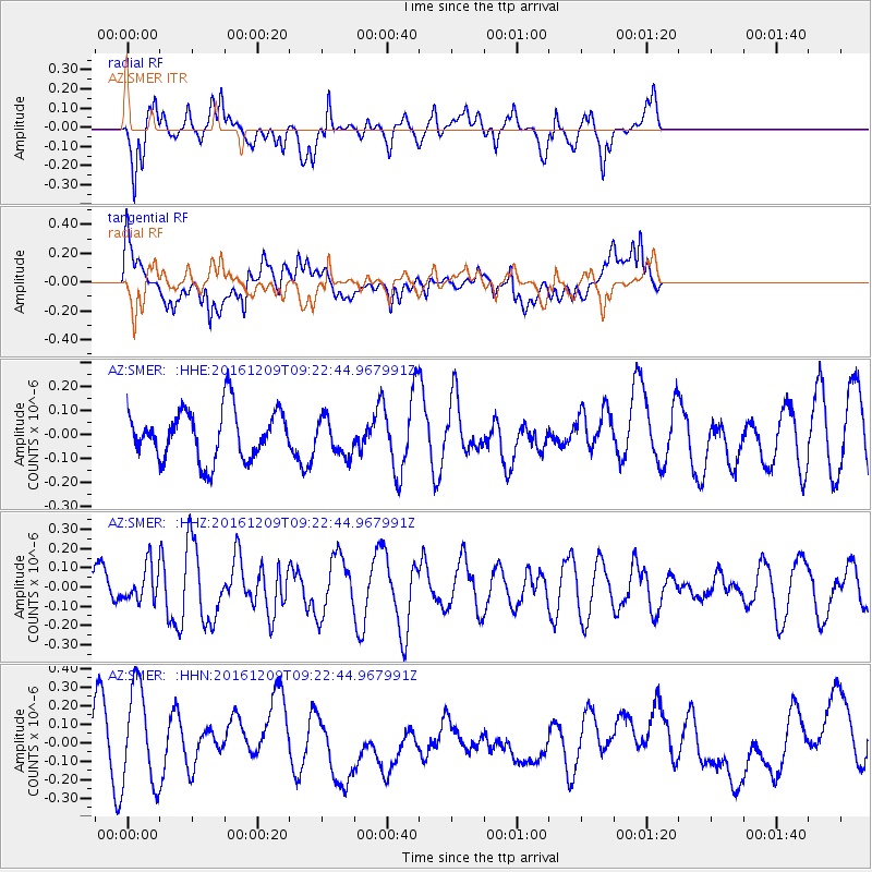
SMER AZ.SMER - Earthquake Result Viewer
*The percent match for this event was below the threshold and hence no stack was calculated.
| Earthquake location: |
Solomon Islands |
| Earthquake latitude/longitude: |
-10.7/161.5 |
| Earthquake time(UTC): |
2016/12/09 (344) 09:10:26 GMT |
| Earthquake Depth: |
42 km |
| Earthquake Magnitude: |
5.5 mb |
| Earthquake Catalog/Contributor: |
NEIC PDE/us |
|
| Network: |
AZ ANZA Regional Network |
| Station: |
SMER AZ.SMER |
| Lat/Lon: |
33.46 N/117.17 W |
| Elevation: |
355 m |
|
| Distance: |
88.8 deg |
| Az: |
55.764 deg |
| Baz: |
256.362 deg |
| Ray Param: |
$rayparam |
*The percent match for this event was below the threshold and hence was not used in the summary stack. |
|
| Radial Match: |
56.086407 % |
| Radial Bump: |
360 |
| Transverse Match: |
42.501144 % |
| Transverse Bump: |
400 |
| SOD ConfigId: |
11737051 |
| Insert Time: |
2019-04-26 06:37:28.219 +0000 |
| GWidth: |
2.5 |
| Max Bumps: |
400 |
| Tol: |
0.001 |
|
Signal To Noise
| Channel | StoN | STA | LTA |
| AZ:SMER: :HHZ:20161209T09:22:44.967991Z | 0.9706807 | 9.439554E-8 | 9.724674E-8 |
| AZ:SMER: :HHN:20161209T09:22:44.967991Z | 2.386891 | 2.6543054E-7 | 1.1120347E-7 |
| AZ:SMER: :HHE:20161209T09:22:44.967991Z | 0.74491835 | 7.7232016E-8 | 1.03678495E-7 |
| Arrivals |
| Ps | |
| PpPs | |
| PsPs/PpSs | |


