You are here: Home > Network List > TA - USArray Transportable Network (new EarthScope stations) Stations List
> Station D25K Kavik River, AK, USA > Earthquake Result Viewer
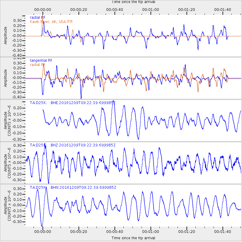
D25K Kavik River, AK, USA - Earthquake Result Viewer
*The percent match for this event was below the threshold and hence no stack was calculated.
| Earthquake location: |
Solomon Islands |
| Earthquake latitude/longitude: |
-10.7/161.5 |
| Earthquake time(UTC): |
2016/12/09 (344) 09:10:26 GMT |
| Earthquake Depth: |
42 km |
| Earthquake Magnitude: |
5.5 mb |
| Earthquake Catalog/Contributor: |
NEIC PDE/us |
|
| Network: |
TA USArray Transportable Network (new EarthScope stations) |
| Station: |
D25K Kavik River, AK, USA |
| Lat/Lon: |
69.32 N/146.38 W |
| Elevation: |
770 m |
|
| Distance: |
87.7 deg |
| Az: |
16.307 deg |
| Baz: |
230.972 deg |
| Ray Param: |
$rayparam |
*The percent match for this event was below the threshold and hence was not used in the summary stack. |
|
| Radial Match: |
55.966553 % |
| Radial Bump: |
400 |
| Transverse Match: |
73.68375 % |
| Transverse Bump: |
400 |
| SOD ConfigId: |
11737051 |
| Insert Time: |
2019-04-26 06:40:01.513 +0000 |
| GWidth: |
2.5 |
| Max Bumps: |
400 |
| Tol: |
0.001 |
|
Signal To Noise
| Channel | StoN | STA | LTA |
| TA:D25K: :BHZ:20161209T09:22:39.699985Z | 1.7892807 | 2.0187917E-7 | 1.12827E-7 |
| TA:D25K: :BHN:20161209T09:22:39.699985Z | 2.576864 | 2.2878855E-7 | 8.878565E-8 |
| TA:D25K: :BHE:20161209T09:22:39.699985Z | 2.3698273 | 1.3814721E-7 | 5.829421E-8 |
| Arrivals |
| Ps | |
| PpPs | |
| PsPs/PpSs | |


