You are here: Home > Network List > AZ - ANZA Regional Network Stations List
> Station SMER AZ.SMER > Earthquake Result Viewer
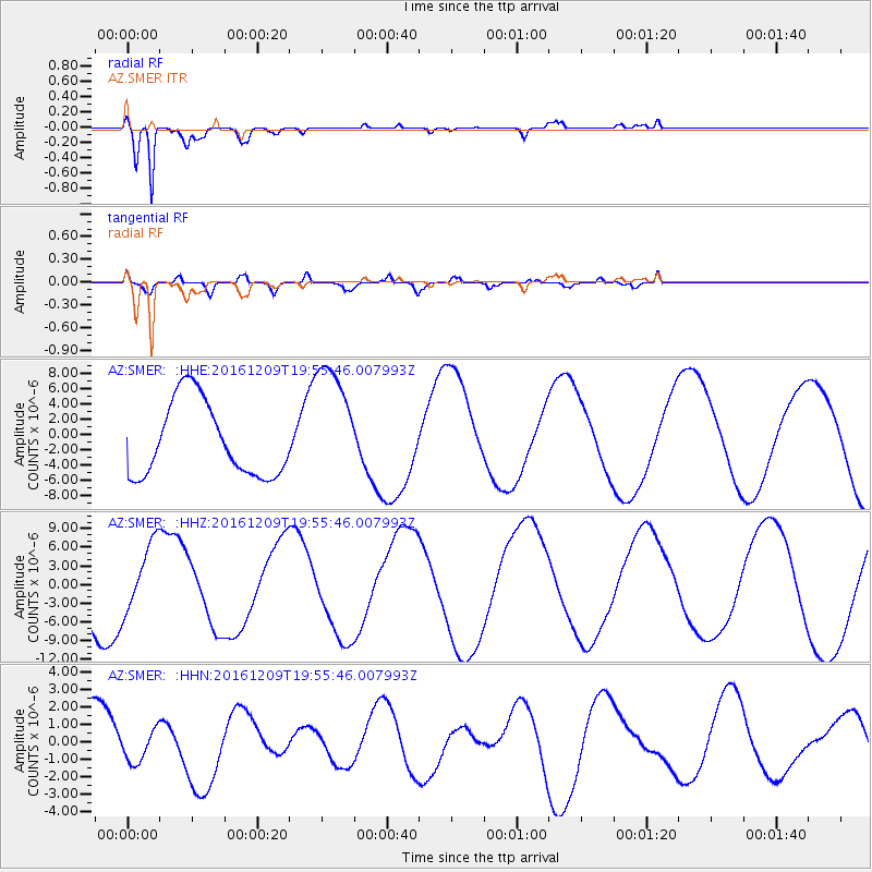
SMER AZ.SMER - Earthquake Result Viewer
*The percent match for this event was below the threshold and hence no stack was calculated.
| Earthquake location: |
Solomon Islands |
| Earthquake latitude/longitude: |
-11.0/161.3 |
| Earthquake time(UTC): |
2016/12/09 (344) 19:43:23 GMT |
| Earthquake Depth: |
18 km |
| Earthquake Magnitude: |
5.5 mb |
| Earthquake Catalog/Contributor: |
NEIC PDE/us |
|
| Network: |
AZ ANZA Regional Network |
| Station: |
SMER AZ.SMER |
| Lat/Lon: |
33.46 N/117.17 W |
| Elevation: |
355 m |
|
| Distance: |
89.0 deg |
| Az: |
55.785 deg |
| Baz: |
256.249 deg |
| Ray Param: |
$rayparam |
*The percent match for this event was below the threshold and hence was not used in the summary stack. |
|
| Radial Match: |
94.72876 % |
| Radial Bump: |
400 |
| Transverse Match: |
74.19141 % |
| Transverse Bump: |
400 |
| SOD ConfigId: |
11737051 |
| Insert Time: |
2019-04-26 06:49:06.859 +0000 |
| GWidth: |
2.5 |
| Max Bumps: |
400 |
| Tol: |
0.001 |
|
Signal To Noise
| Channel | StoN | STA | LTA |
| AZ:SMER: :HHZ:20161209T19:55:46.007993Z | 1.045228 | 5.4382594E-6 | 5.2029404E-6 |
| AZ:SMER: :HHN:20161209T19:55:46.007993Z | 0.59563464 | 9.285209E-7 | 1.5588766E-6 |
| AZ:SMER: :HHE:20161209T19:55:46.007993Z | 1.6870242 | 8.251827E-6 | 4.8913507E-6 |
| Arrivals |
| Ps | |
| PpPs | |
| PsPs/PpSs | |


