You are here: Home > Network List > TA - USArray Transportable Network (new EarthScope stations) Stations List
> Station R31K City Hall, Gustavus, AK, USA > Earthquake Result Viewer
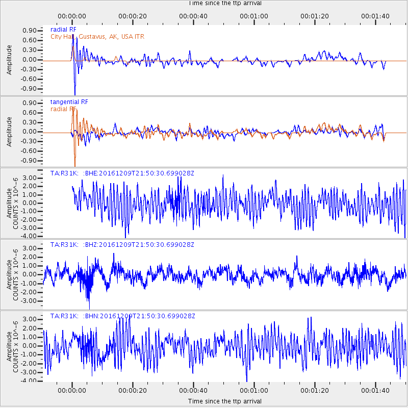
R31K City Hall, Gustavus, AK, USA - Earthquake Result Viewer
*The percent match for this event was below the threshold and hence no stack was calculated.
| Earthquake location: |
Solomon Islands |
| Earthquake latitude/longitude: |
-10.9/161.4 |
| Earthquake time(UTC): |
2016/12/09 (344) 21:38:23 GMT |
| Earthquake Depth: |
10 km |
| Earthquake Magnitude: |
5.8 Mww |
| Earthquake Catalog/Contributor: |
NEIC PDE/us |
|
| Network: |
TA USArray Transportable Network (new EarthScope stations) |
| Station: |
R31K City Hall, Gustavus, AK, USA |
| Lat/Lon: |
58.41 N/135.74 W |
| Elevation: |
15 m |
|
| Distance: |
85.7 deg |
| Az: |
28.014 deg |
| Baz: |
241.21 deg |
| Ray Param: |
$rayparam |
*The percent match for this event was below the threshold and hence was not used in the summary stack. |
|
| Radial Match: |
51.38488 % |
| Radial Bump: |
400 |
| Transverse Match: |
49.30872 % |
| Transverse Bump: |
400 |
| SOD ConfigId: |
11737051 |
| Insert Time: |
2019-04-26 06:57:07.058 +0000 |
| GWidth: |
2.5 |
| Max Bumps: |
400 |
| Tol: |
0.001 |
|
Signal To Noise
| Channel | StoN | STA | LTA |
| TA:R31K: :BHZ:20161209T21:50:30.699028Z | 1.0323107 | 6.5695605E-7 | 6.363937E-7 |
| TA:R31K: :BHN:20161209T21:50:30.699028Z | 0.78730786 | 1.0291051E-6 | 1.3071191E-6 |
| TA:R31K: :BHE:20161209T21:50:30.699028Z | 0.76131266 | 1.0759844E-6 | 1.4133279E-6 |
| Arrivals |
| Ps | |
| PpPs | |
| PsPs/PpSs | |


