You are here: Home > Network List > CI - Caltech Regional Seismic Network Stations List
> Station MPM Manuel Prospect Mine, California, USA > Earthquake Result Viewer
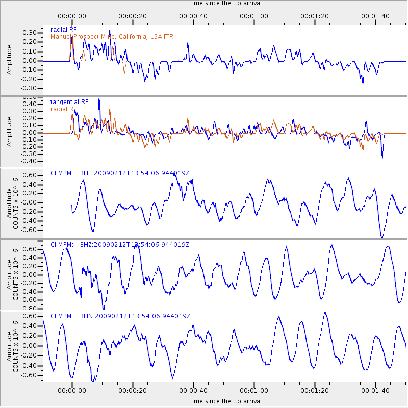
MPM Manuel Prospect Mine, California, USA - Earthquake Result Viewer
*The percent match for this event was below the threshold and hence no stack was calculated.
| Earthquake location: |
South Of Mariana Islands |
| Earthquake latitude/longitude: |
12.1/143.8 |
| Earthquake time(UTC): |
2009/02/12 (043) 13:41:43 GMT |
| Earthquake Depth: |
40 km |
| Earthquake Magnitude: |
5.5 MB |
| Earthquake Catalog/Contributor: |
WHDF/NEIC |
|
| Network: |
CI Caltech Regional Seismic Network |
| Station: |
MPM Manuel Prospect Mine, California, USA |
| Lat/Lon: |
36.06 N/117.49 W |
| Elevation: |
185 m |
|
| Distance: |
89.9 deg |
| Az: |
53.214 deg |
| Baz: |
284.865 deg |
| Ray Param: |
$rayparam |
*The percent match for this event was below the threshold and hence was not used in the summary stack. |
|
| Radial Match: |
63.51022 % |
| Radial Bump: |
400 |
| Transverse Match: |
50.165035 % |
| Transverse Bump: |
400 |
| SOD ConfigId: |
2658 |
| Insert Time: |
2010-03-05 20:27:40.904 +0000 |
| GWidth: |
2.5 |
| Max Bumps: |
400 |
| Tol: |
0.001 |
|
Signal To Noise
| Channel | StoN | STA | LTA |
| CI:MPM: :BHZ:20090212T13:54:06.944019Z | 0.9762303 | 3.066372E-7 | 3.1410335E-7 |
| CI:MPM: :BHN:20090212T13:54:06.944019Z | 1.2278441 | 4.4560073E-7 | 3.629131E-7 |
| CI:MPM: :BHE:20090212T13:54:06.944019Z | 1.7681271 | 4.2200168E-7 | 2.386716E-7 |
| Arrivals |
| Ps | |
| PpPs | |
| PsPs/PpSs | |


