You are here: Home > Network List > CI - Caltech Regional Seismic Network Stations List
> Station MPM Manuel Prospect Mine, California, USA > Earthquake Result Viewer
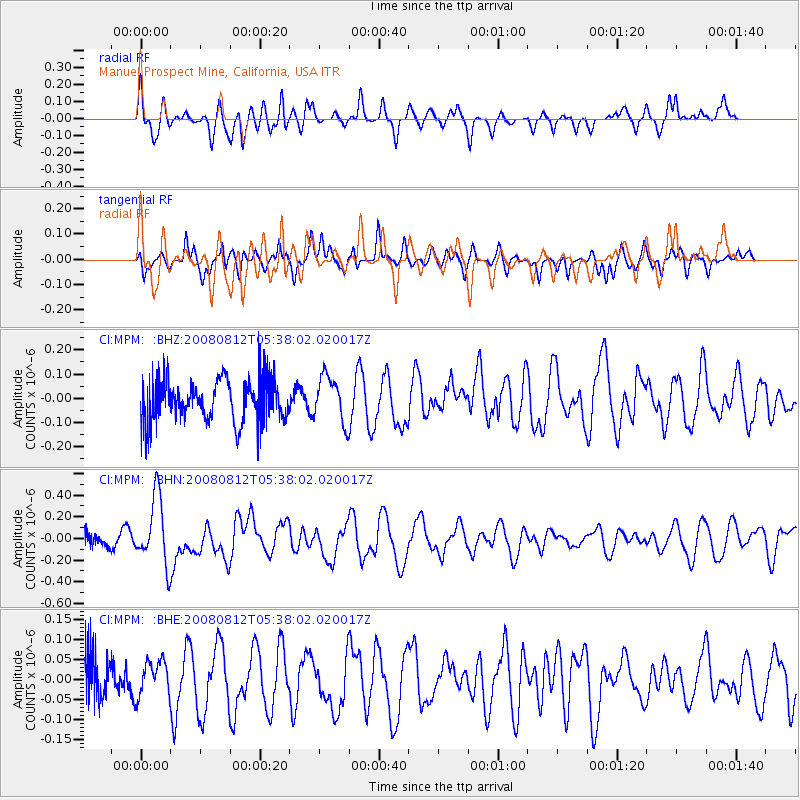
MPM Manuel Prospect Mine, California, USA - Earthquake Result Viewer
*The percent match for this event was below the threshold and hence no stack was calculated.
| Earthquake location: |
Santa Cruz Islands |
| Earthquake latitude/longitude: |
-11.4/166.2 |
| Earthquake time(UTC): |
2008/08/12 (225) 05:25:57 GMT |
| Earthquake Depth: |
38 km |
| Earthquake Magnitude: |
5.9 MW, 5.4 MS, 5.2 MB, 5.8 MW |
| Earthquake Catalog/Contributor: |
WHDF/NEIC |
|
| Network: |
CI Caltech Regional Seismic Network |
| Station: |
MPM Manuel Prospect Mine, California, USA |
| Lat/Lon: |
36.06 N/117.49 W |
| Elevation: |
185 m |
|
| Distance: |
85.8 deg |
| Az: |
52.119 deg |
| Baz: |
252.745 deg |
| Ray Param: |
$rayparam |
*The percent match for this event was below the threshold and hence was not used in the summary stack. |
|
| Radial Match: |
63.59587 % |
| Radial Bump: |
365 |
| Transverse Match: |
67.8287 % |
| Transverse Bump: |
353 |
| SOD ConfigId: |
2504 |
| Insert Time: |
2010-03-05 20:27:51.463 +0000 |
| GWidth: |
2.5 |
| Max Bumps: |
400 |
| Tol: |
0.001 |
|
Signal To Noise
| Channel | StoN | STA | LTA |
| CI:MPM: :BHN:20080812T05:38:02.020017Z | 4.323817 | 3.109434E-7 | 7.19141E-8 |
| CI:MPM: :BHE:20080812T05:38:02.020017Z | 0.548543 | 4.3134516E-8 | 7.8634706E-8 |
| CI:MPM: :BHZ:20080812T05:38:02.020017Z | 1.1146816 | 9.514533E-8 | 8.535651E-8 |
| Arrivals |
| Ps | |
| PpPs | |
| PsPs/PpSs | |


