You are here: Home > Network List > CI - Caltech Regional Seismic Network Stations List
> Station MPM Manuel Prospect Mine, California, USA > Earthquake Result Viewer
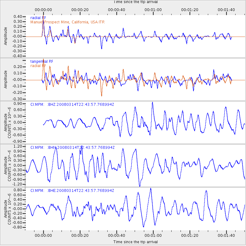
MPM Manuel Prospect Mine, California, USA - Earthquake Result Viewer
*The percent match for this event was below the threshold and hence no stack was calculated.
| Earthquake location: |
Bonin Islands, Japan Region |
| Earthquake latitude/longitude: |
27.0/142.6 |
| Earthquake time(UTC): |
2008/03/14 (074) 22:32:09 GMT |
| Earthquake Depth: |
11 km |
| Earthquake Magnitude: |
5.7 MB, 5.9 MS, 6.0 MW, 6.0 MW |
| Earthquake Catalog/Contributor: |
WHDF/NEIC |
|
| Network: |
CI Caltech Regional Seismic Network |
| Station: |
MPM Manuel Prospect Mine, California, USA |
| Lat/Lon: |
36.06 N/117.49 W |
| Elevation: |
185 m |
|
| Distance: |
82.0 deg |
| Az: |
53.721 deg |
| Baz: |
297.407 deg |
| Ray Param: |
$rayparam |
*The percent match for this event was below the threshold and hence was not used in the summary stack. |
|
| Radial Match: |
68.688 % |
| Radial Bump: |
383 |
| Transverse Match: |
41.735188 % |
| Transverse Bump: |
397 |
| SOD ConfigId: |
2504 |
| Insert Time: |
2010-03-05 20:27:53.931 +0000 |
| GWidth: |
2.5 |
| Max Bumps: |
400 |
| Tol: |
0.001 |
|
Signal To Noise
| Channel | StoN | STA | LTA |
| CI:MPM: :BHN:20080314T22:43:57.768994Z | 2.5739288 | 5.848797E-7 | 2.2723226E-7 |
| CI:MPM: :BHE:20080314T22:43:57.768994Z | 0.66036433 | 1.2851366E-7 | 1.9461024E-7 |
| CI:MPM: :BHZ:20080314T22:43:57.768994Z | 1.6653613 | 2.1767114E-7 | 1.3070506E-7 |
| Arrivals |
| Ps | |
| PpPs | |
| PsPs/PpSs | |


