You are here: Home > Network List > CI - Caltech Regional Seismic Network Stations List
> Station BAR Barrett, Tecate, CA, USA > Earthquake Result Viewer
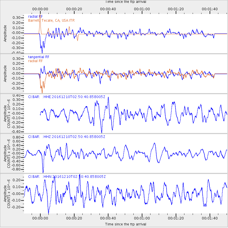
BAR Barrett, Tecate, CA, USA - Earthquake Result Viewer
*The percent match for this event was below the threshold and hence no stack was calculated.
| Earthquake location: |
Solomon Islands |
| Earthquake latitude/longitude: |
-10.3/161.3 |
| Earthquake time(UTC): |
2016/12/10 (345) 02:38:21 GMT |
| Earthquake Depth: |
36 km |
| Earthquake Magnitude: |
5.6 Mwp |
| Earthquake Catalog/Contributor: |
NEIC PDE/us |
|
| Network: |
CI Caltech Regional Seismic Network |
| Station: |
BAR Barrett, Tecate, CA, USA |
| Lat/Lon: |
32.68 N/116.67 W |
| Elevation: |
521 m |
|
| Distance: |
88.9 deg |
| Az: |
56.648 deg |
| Baz: |
257.067 deg |
| Ray Param: |
$rayparam |
*The percent match for this event was below the threshold and hence was not used in the summary stack. |
|
| Radial Match: |
71.2535 % |
| Radial Bump: |
400 |
| Transverse Match: |
46.98293 % |
| Transverse Bump: |
400 |
| SOD ConfigId: |
11737051 |
| Insert Time: |
2019-04-26 07:08:19.380 +0000 |
| GWidth: |
2.5 |
| Max Bumps: |
400 |
| Tol: |
0.001 |
|
Signal To Noise
| Channel | StoN | STA | LTA |
| CI:BAR: :HHZ:20161210T02:50:40.858005Z | 2.2824957 | 3.5142017E-7 | 1.5396313E-7 |
| CI:BAR: :HHN:20161210T02:50:40.858005Z | 0.94896656 | 1.149725E-7 | 1.2115548E-7 |
| CI:BAR: :HHE:20161210T02:50:40.858005Z | 2.5335186 | 1.9383543E-7 | 7.650839E-8 |
| Arrivals |
| Ps | |
| PpPs | |
| PsPs/PpSs | |


