You are here: Home > Network List > CI - Caltech Regional Seismic Network Stations List
> Station MPM Manuel Prospect Mine, California, USA > Earthquake Result Viewer
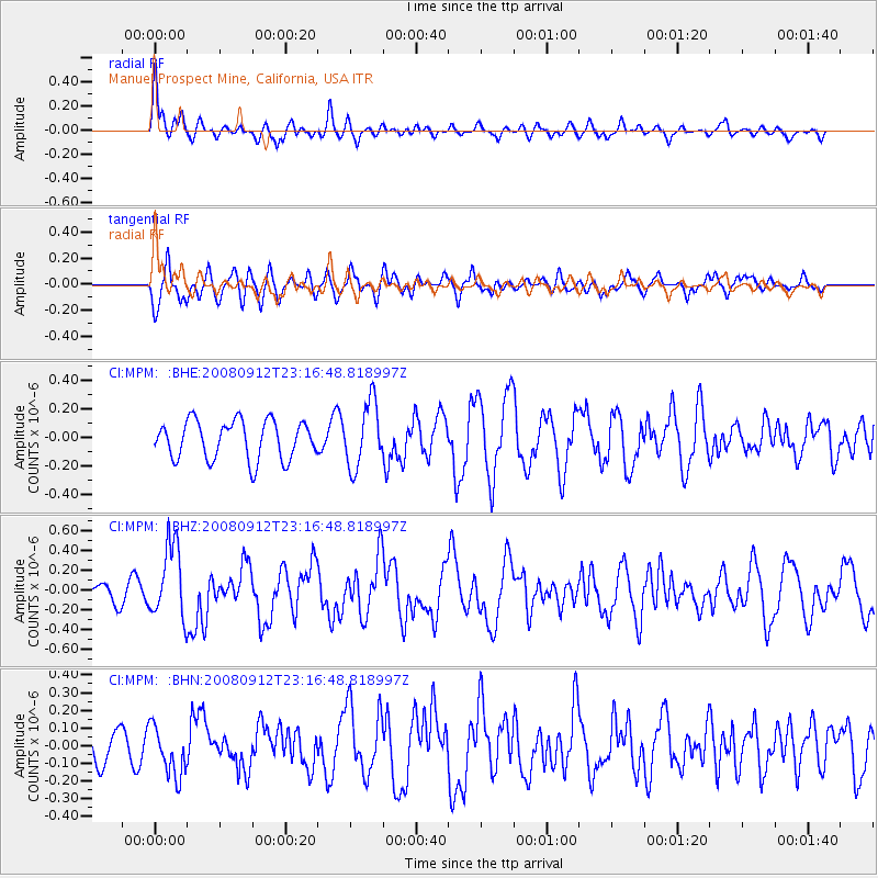
MPM Manuel Prospect Mine, California, USA - Earthquake Result Viewer
*The percent match for this event was below the threshold and hence no stack was calculated.
| Earthquake location: |
Komandorskiye Ostrova Region |
| Earthquake latitude/longitude: |
56.3/164.1 |
| Earthquake time(UTC): |
2008/09/12 (256) 23:07:50 GMT |
| Earthquake Depth: |
9.3 km |
| Earthquake Magnitude: |
5.5 MB, 5.7 MS, 5.9 MW, 5.9 MW |
| Earthquake Catalog/Contributor: |
WHDF/NEIC |
|
| Network: |
CI Caltech Regional Seismic Network |
| Station: |
MPM Manuel Prospect Mine, California, USA |
| Lat/Lon: |
36.06 N/117.49 W |
| Elevation: |
185 m |
|
| Distance: |
54.7 deg |
| Az: |
76.431 deg |
| Baz: |
318.039 deg |
| Ray Param: |
$rayparam |
*The percent match for this event was below the threshold and hence was not used in the summary stack. |
|
| Radial Match: |
59.467068 % |
| Radial Bump: |
400 |
| Transverse Match: |
67.18093 % |
| Transverse Bump: |
400 |
| SOD ConfigId: |
2560 |
| Insert Time: |
2010-03-05 20:28:23.083 +0000 |
| GWidth: |
2.5 |
| Max Bumps: |
400 |
| Tol: |
0.001 |
|
Signal To Noise
| Channel | StoN | STA | LTA |
| CI:MPM: :BHZ:20080912T23:16:48.818997Z | 3.7109568 | 3.7507036E-7 | 1.01071066E-7 |
| CI:MPM: :BHN:20080912T23:16:48.818997Z | 1.2979046 | 1.3974076E-7 | 1.0766644E-7 |
| CI:MPM: :BHE:20080912T23:16:48.818997Z | 1.6879418 | 2.2712787E-7 | 1.3455906E-7 |
| Arrivals |
| Ps | |
| PpPs | |
| PsPs/PpSs | |


