You are here: Home > Network List > CI - Caltech Regional Seismic Network Stations List
> Station MPM Manuel Prospect Mine, California, USA > Earthquake Result Viewer
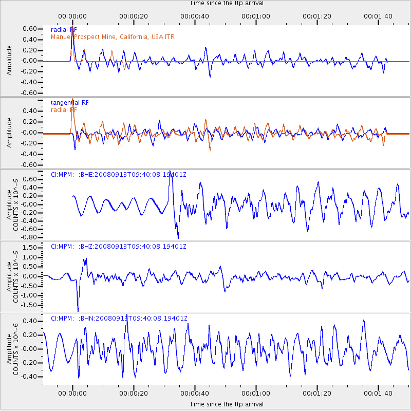
MPM Manuel Prospect Mine, California, USA - Earthquake Result Viewer
*The percent match for this event was below the threshold and hence no stack was calculated.
| Earthquake location: |
Colombia |
| Earthquake latitude/longitude: |
4.8/-75.5 |
| Earthquake time(UTC): |
2008/09/13 (257) 09:32:01 GMT |
| Earthquake Depth: |
133 km |
| Earthquake Magnitude: |
5.9 MB, 5.7 MW, 5.7 MW |
| Earthquake Catalog/Contributor: |
WHDF/NEIC |
|
| Network: |
CI Caltech Regional Seismic Network |
| Station: |
MPM Manuel Prospect Mine, California, USA |
| Lat/Lon: |
36.06 N/117.49 W |
| Elevation: |
185 m |
|
| Distance: |
49.5 deg |
| Az: |
314.581 deg |
| Baz: |
118.839 deg |
| Ray Param: |
$rayparam |
*The percent match for this event was below the threshold and hence was not used in the summary stack. |
|
| Radial Match: |
77.818535 % |
| Radial Bump: |
400 |
| Transverse Match: |
61.3728 % |
| Transverse Bump: |
400 |
| SOD ConfigId: |
2560 |
| Insert Time: |
2010-03-05 20:28:24.548 +0000 |
| GWidth: |
2.5 |
| Max Bumps: |
400 |
| Tol: |
0.001 |
|
Signal To Noise
| Channel | StoN | STA | LTA |
| CI:MPM: :BHZ:20080913T09:40:08.19401Z | 8.649561 | 6.736736E-7 | 7.7885296E-8 |
| CI:MPM: :BHN:20080913T09:40:08.19401Z | 1.6012287 | 1.7577807E-7 | 1.0977699E-7 |
| CI:MPM: :BHE:20080913T09:40:08.19401Z | 3.439443 | 4.4748242E-7 | 1.3010316E-7 |
| Arrivals |
| Ps | |
| PpPs | |
| PsPs/PpSs | |


