You are here: Home > Network List > CI - Caltech Regional Seismic Network Stations List
> Station MPM Manuel Prospect Mine, California, USA > Earthquake Result Viewer
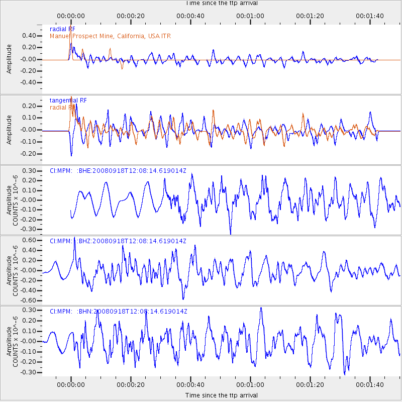
MPM Manuel Prospect Mine, California, USA - Earthquake Result Viewer
*The percent match for this event was below the threshold and hence no stack was calculated.
| Earthquake location: |
Near East Coast Of Kamchatka |
| Earthquake latitude/longitude: |
51.9/158.4 |
| Earthquake time(UTC): |
2008/09/18 (262) 11:58:50 GMT |
| Earthquake Depth: |
67 km |
| Earthquake Magnitude: |
5.7 MB, 5.9 MW, 5.8 MW |
| Earthquake Catalog/Contributor: |
WHDF/NEIC |
|
| Network: |
CI Caltech Regional Seismic Network |
| Station: |
MPM Manuel Prospect Mine, California, USA |
| Lat/Lon: |
36.06 N/117.49 W |
| Elevation: |
185 m |
|
| Distance: |
59.2 deg |
| Az: |
69.722 deg |
| Baz: |
314.197 deg |
| Ray Param: |
$rayparam |
*The percent match for this event was below the threshold and hence was not used in the summary stack. |
|
| Radial Match: |
57.504044 % |
| Radial Bump: |
400 |
| Transverse Match: |
69.77351 % |
| Transverse Bump: |
400 |
| SOD ConfigId: |
2560 |
| Insert Time: |
2010-03-05 20:28:25.899 +0000 |
| GWidth: |
2.5 |
| Max Bumps: |
400 |
| Tol: |
0.001 |
|
Signal To Noise
| Channel | StoN | STA | LTA |
| CI:MPM: :BHZ:20080918T12:08:14.619014Z | 2.45042 | 2.2874615E-7 | 9.334977E-8 |
| CI:MPM: :BHN:20080918T12:08:14.619014Z | 1.4435105 | 9.836656E-8 | 6.814398E-8 |
| CI:MPM: :BHE:20080918T12:08:14.619014Z | 0.8760508 | 8.438117E-8 | 9.631996E-8 |
| Arrivals |
| Ps | |
| PpPs | |
| PsPs/PpSs | |


