You are here: Home > Network List > CI - Caltech Regional Seismic Network Stations List
> Station MPM Manuel Prospect Mine, California, USA > Earthquake Result Viewer
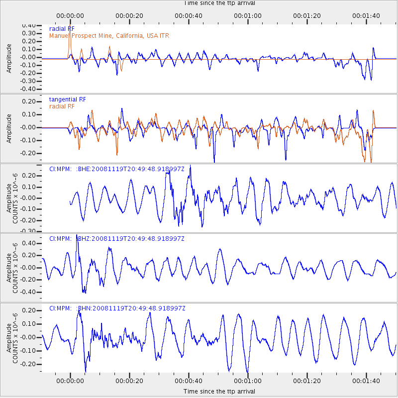
MPM Manuel Prospect Mine, California, USA - Earthquake Result Viewer
*The percent match for this event was below the threshold and hence no stack was calculated.
| Earthquake location: |
South Of Fiji Islands |
| Earthquake latitude/longitude: |
-22.2/-179.7 |
| Earthquake time(UTC): |
2008/11/19 (324) 20:38:58 GMT |
| Earthquake Depth: |
596 km |
| Earthquake Magnitude: |
5.8 MW, 5.2 MB, 5.8 MW |
| Earthquake Catalog/Contributor: |
WHDF/NEIC |
|
| Network: |
CI Caltech Regional Seismic Network |
| Station: |
MPM Manuel Prospect Mine, California, USA |
| Lat/Lon: |
36.06 N/117.49 W |
| Elevation: |
185 m |
|
| Distance: |
82.5 deg |
| Az: |
46.312 deg |
| Baz: |
235.814 deg |
| Ray Param: |
$rayparam |
*The percent match for this event was below the threshold and hence was not used in the summary stack. |
|
| Radial Match: |
45.625557 % |
| Radial Bump: |
400 |
| Transverse Match: |
64.614944 % |
| Transverse Bump: |
308 |
| SOD ConfigId: |
2658 |
| Insert Time: |
2010-03-05 20:28:30.633 +0000 |
| GWidth: |
2.5 |
| Max Bumps: |
400 |
| Tol: |
0.001 |
|
Signal To Noise
| Channel | StoN | STA | LTA |
| CI:MPM: :BHZ:20081119T20:49:48.918997Z | 2.0262647 | 2.5345315E-7 | 1.2508393E-7 |
| CI:MPM: :BHN:20081119T20:49:48.918997Z | 0.86498594 | 1.1167277E-7 | 1.2910357E-7 |
| CI:MPM: :BHE:20081119T20:49:48.918997Z | 1.8958092 | 1.6238847E-7 | 8.565655E-8 |
| Arrivals |
| Ps | |
| PpPs | |
| PsPs/PpSs | |


