You are here: Home > Network List > TA - USArray Transportable Network (new EarthScope stations) Stations List
> Station J26L Joseph Creek, AK, USA > Earthquake Result Viewer
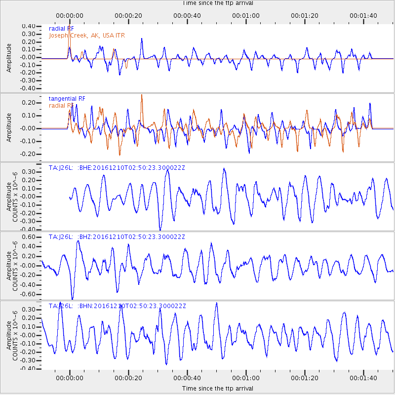
J26L Joseph Creek, AK, USA - Earthquake Result Viewer
*The percent match for this event was below the threshold and hence no stack was calculated.
| Earthquake location: |
Solomon Islands |
| Earthquake latitude/longitude: |
-10.3/161.3 |
| Earthquake time(UTC): |
2016/12/10 (345) 02:38:21 GMT |
| Earthquake Depth: |
36 km |
| Earthquake Magnitude: |
5.6 Mwp |
| Earthquake Catalog/Contributor: |
NEIC PDE/us |
|
| Network: |
TA USArray Transportable Network (new EarthScope stations) |
| Station: |
J26L Joseph Creek, AK, USA |
| Lat/Lon: |
64.50 N/143.56 W |
| Elevation: |
1144 m |
|
| Distance: |
85.2 deg |
| Az: |
20.874 deg |
| Baz: |
234.095 deg |
| Ray Param: |
$rayparam |
*The percent match for this event was below the threshold and hence was not used in the summary stack. |
|
| Radial Match: |
58.62974 % |
| Radial Bump: |
400 |
| Transverse Match: |
44.034252 % |
| Transverse Bump: |
333 |
| SOD ConfigId: |
11737051 |
| Insert Time: |
2019-04-26 07:12:02.430 +0000 |
| GWidth: |
2.5 |
| Max Bumps: |
400 |
| Tol: |
0.001 |
|
Signal To Noise
| Channel | StoN | STA | LTA |
| TA:J26L: :BHZ:20161210T02:50:23.300022Z | 2.1391537 | 3.6960606E-7 | 1.7278145E-7 |
| TA:J26L: :BHN:20161210T02:50:23.300022Z | 0.692937 | 1.4247283E-7 | 2.0560718E-7 |
| TA:J26L: :BHE:20161210T02:50:23.300022Z | 2.0279913 | 2.3588719E-7 | 1.16315675E-7 |
| Arrivals |
| Ps | |
| PpPs | |
| PsPs/PpSs | |


