You are here: Home > Network List > CI - Caltech Regional Seismic Network Stations List
> Station MPM Manuel Prospect Mine, California, USA > Earthquake Result Viewer
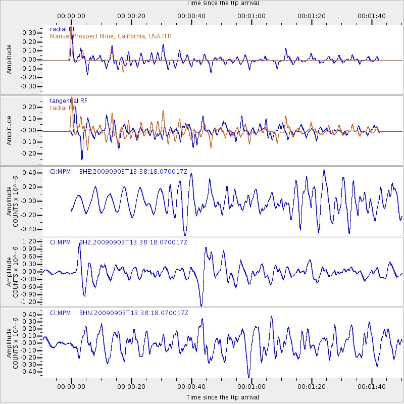
MPM Manuel Prospect Mine, California, USA - Earthquake Result Viewer
*The percent match for this event was below the threshold and hence no stack was calculated.
| Earthquake location: |
Kyushu, Japan |
| Earthquake latitude/longitude: |
31.1/130.0 |
| Earthquake time(UTC): |
2009/09/03 (246) 13:26:18 GMT |
| Earthquake Depth: |
166 km |
| Earthquake Magnitude: |
5.9 MB, 6.2 MW, 6.2 MW |
| Earthquake Catalog/Contributor: |
WHDF/NEIC |
|
| Network: |
CI Caltech Regional Seismic Network |
| Station: |
MPM Manuel Prospect Mine, California, USA |
| Lat/Lon: |
36.06 N/117.49 W |
| Elevation: |
185 m |
|
| Distance: |
87.9 deg |
| Az: |
48.518 deg |
| Baz: |
307.558 deg |
| Ray Param: |
$rayparam |
*The percent match for this event was below the threshold and hence was not used in the summary stack. |
|
| Radial Match: |
64.90039 % |
| Radial Bump: |
378 |
| Transverse Match: |
71.19923 % |
| Transverse Bump: |
353 |
| SOD ConfigId: |
2622 |
| Insert Time: |
2010-03-05 20:28:36.415 +0000 |
| GWidth: |
2.5 |
| Max Bumps: |
400 |
| Tol: |
0.001 |
|
Signal To Noise
| Channel | StoN | STA | LTA |
| CI:MPM: :BHZ:20090903T13:38:18.070017Z | 5.774258 | 5.359066E-7 | 9.28096E-8 |
| CI:MPM: :BHN:20090903T13:38:18.070017Z | 1.5328441 | 1.03729356E-7 | 6.7671174E-8 |
| CI:MPM: :BHE:20090903T13:38:18.070017Z | 1.2800732 | 1.498662E-7 | 1.17076276E-7 |
| Arrivals |
| Ps | |
| PpPs | |
| PsPs/PpSs | |


