You are here: Home > Network List > TA - USArray Transportable Network (new EarthScope stations) Stations List
> Station TPFO Pinon Flats, CA, USA > Earthquake Result Viewer
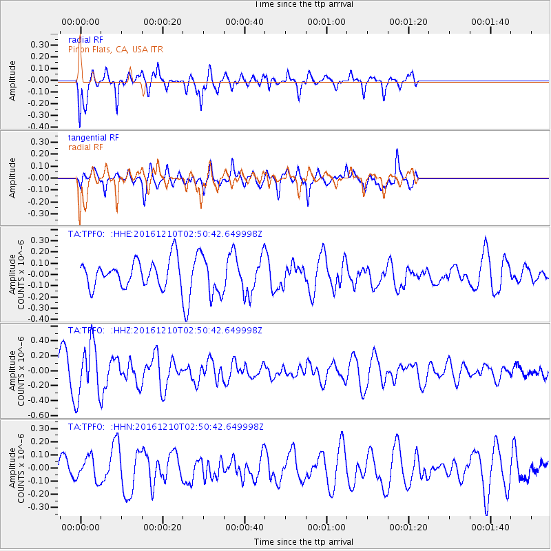
TPFO Pinon Flats, CA, USA - Earthquake Result Viewer
*The percent match for this event was below the threshold and hence no stack was calculated.
| Earthquake location: |
Solomon Islands |
| Earthquake latitude/longitude: |
-10.3/161.3 |
| Earthquake time(UTC): |
2016/12/10 (345) 02:38:21 GMT |
| Earthquake Depth: |
36 km |
| Earthquake Magnitude: |
5.6 Mwp |
| Earthquake Catalog/Contributor: |
NEIC PDE/us |
|
| Network: |
TA USArray Transportable Network (new EarthScope stations) |
| Station: |
TPFO Pinon Flats, CA, USA |
| Lat/Lon: |
33.61 N/116.45 W |
| Elevation: |
1275 m |
|
| Distance: |
89.3 deg |
| Az: |
55.789 deg |
| Baz: |
257.172 deg |
| Ray Param: |
$rayparam |
*The percent match for this event was below the threshold and hence was not used in the summary stack. |
|
| Radial Match: |
71.11737 % |
| Radial Bump: |
400 |
| Transverse Match: |
56.160522 % |
| Transverse Bump: |
400 |
| SOD ConfigId: |
11737051 |
| Insert Time: |
2019-04-26 07:12:23.915 +0000 |
| GWidth: |
2.5 |
| Max Bumps: |
400 |
| Tol: |
0.001 |
|
Signal To Noise
| Channel | StoN | STA | LTA |
| TA:TPFO: :HHZ:20161210T02:50:42.649998Z | 2.1276095 | 3.5086566E-7 | 1.6491073E-7 |
| TA:TPFO: :HHN:20161210T02:50:42.649998Z | 1.257644 | 9.0911605E-8 | 7.228723E-8 |
| TA:TPFO: :HHE:20161210T02:50:42.649998Z | 1.5635874 | 1.7848514E-7 | 1.1415105E-7 |
| Arrivals |
| Ps | |
| PpPs | |
| PsPs/PpSs | |


