You are here: Home > Network List > CI - Caltech Regional Seismic Network Stations List
> Station MPM Manuel Prospect Mine, California, USA > Earthquake Result Viewer
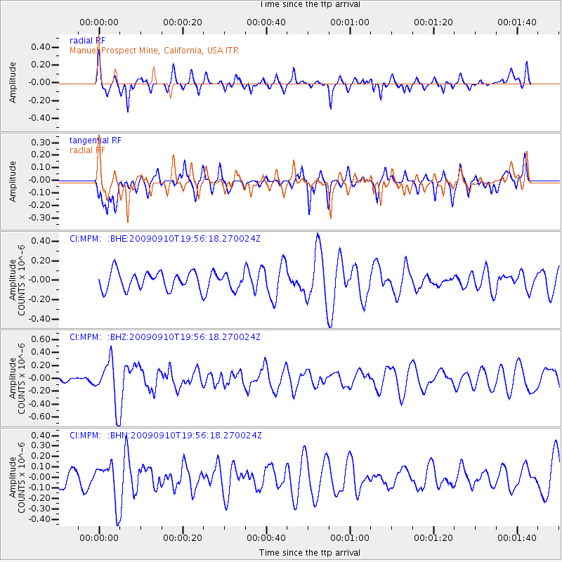
MPM Manuel Prospect Mine, California, USA - Earthquake Result Viewer
*The percent match for this event was below the threshold and hence no stack was calculated.
| Earthquake location: |
Easter Island Region |
| Earthquake latitude/longitude: |
-29.9/-111.8 |
| Earthquake time(UTC): |
2009/09/10 (253) 19:46:03 GMT |
| Earthquake Depth: |
10 km |
| Earthquake Magnitude: |
5.5 MW, 5.4 MB |
| Earthquake Catalog/Contributor: |
WHDF/NEIC |
|
| Network: |
CI Caltech Regional Seismic Network |
| Station: |
MPM Manuel Prospect Mine, California, USA |
| Lat/Lon: |
36.06 N/117.49 W |
| Elevation: |
185 m |
|
| Distance: |
65.9 deg |
| Az: |
354.971 deg |
| Baz: |
174.611 deg |
| Ray Param: |
$rayparam |
*The percent match for this event was below the threshold and hence was not used in the summary stack. |
|
| Radial Match: |
68.10538 % |
| Radial Bump: |
339 |
| Transverse Match: |
52.256226 % |
| Transverse Bump: |
379 |
| SOD ConfigId: |
2622 |
| Insert Time: |
2010-03-05 20:28:37.367 +0000 |
| GWidth: |
2.5 |
| Max Bumps: |
400 |
| Tol: |
0.001 |
|
Signal To Noise
| Channel | StoN | STA | LTA |
| CI:MPM: :BHZ:20090910T19:56:18.270024Z | 2.7788053 | 3.5110034E-7 | 1.2634939E-7 |
| CI:MPM: :BHN:20090910T19:56:18.270024Z | 2.0301838 | 1.9459736E-7 | 9.5852094E-8 |
| CI:MPM: :BHE:20090910T19:56:18.270024Z | 0.85383874 | 7.7194244E-8 | 9.0408456E-8 |
| Arrivals |
| Ps | |
| PpPs | |
| PsPs/PpSs | |


