You are here: Home > Network List > CI - Caltech Regional Seismic Network Stations List
> Station MPM Manuel Prospect Mine, California, USA > Earthquake Result Viewer
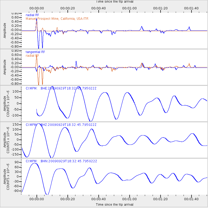
MPM Manuel Prospect Mine, California, USA - Earthquake Result Viewer
*The percent match for this event was below the threshold and hence no stack was calculated.
| Earthquake location: |
Samoa Islands Region |
| Earthquake latitude/longitude: |
-16.2/-173.0 |
| Earthquake time(UTC): |
2009/09/29 (272) 18:21:42 GMT |
| Earthquake Depth: |
10 km |
| Earthquake Magnitude: |
5.8 MB |
| Earthquake Catalog/Contributor: |
WHDF/NEIC |
|
| Network: |
CI Caltech Regional Seismic Network |
| Station: |
MPM Manuel Prospect Mine, California, USA |
| Lat/Lon: |
36.06 N/117.49 W |
| Elevation: |
185 m |
|
| Distance: |
73.8 deg |
| Az: |
44.043 deg |
| Baz: |
235.517 deg |
| Ray Param: |
$rayparam |
*The percent match for this event was below the threshold and hence was not used in the summary stack. |
|
| Radial Match: |
91.76667 % |
| Radial Bump: |
400 |
| Transverse Match: |
91.87854 % |
| Transverse Bump: |
397 |
| SOD ConfigId: |
2622 |
| Insert Time: |
2010-03-05 20:28:40.790 +0000 |
| GWidth: |
2.5 |
| Max Bumps: |
400 |
| Tol: |
0.001 |
|
Signal To Noise
| Channel | StoN | STA | LTA |
| CI:MPM: :BHZ:20090929T18:32:45.795022Z | 1.501152 | 1.5616263E-4 | 1.0402852E-4 |
| CI:MPM: :BHN:20090929T18:32:45.795022Z | 1.1071242 | 6.810111E-5 | 6.151172E-5 |
| CI:MPM: :BHE:20090929T18:32:45.795022Z | 1.026772 | 8.677137E-5 | 8.4508894E-5 |
| Arrivals |
| Ps | |
| PpPs | |
| PsPs/PpSs | |


