You are here: Home > Network List > CI - Caltech Regional Seismic Network Stations List
> Station MPM Manuel Prospect Mine, California, USA > Earthquake Result Viewer
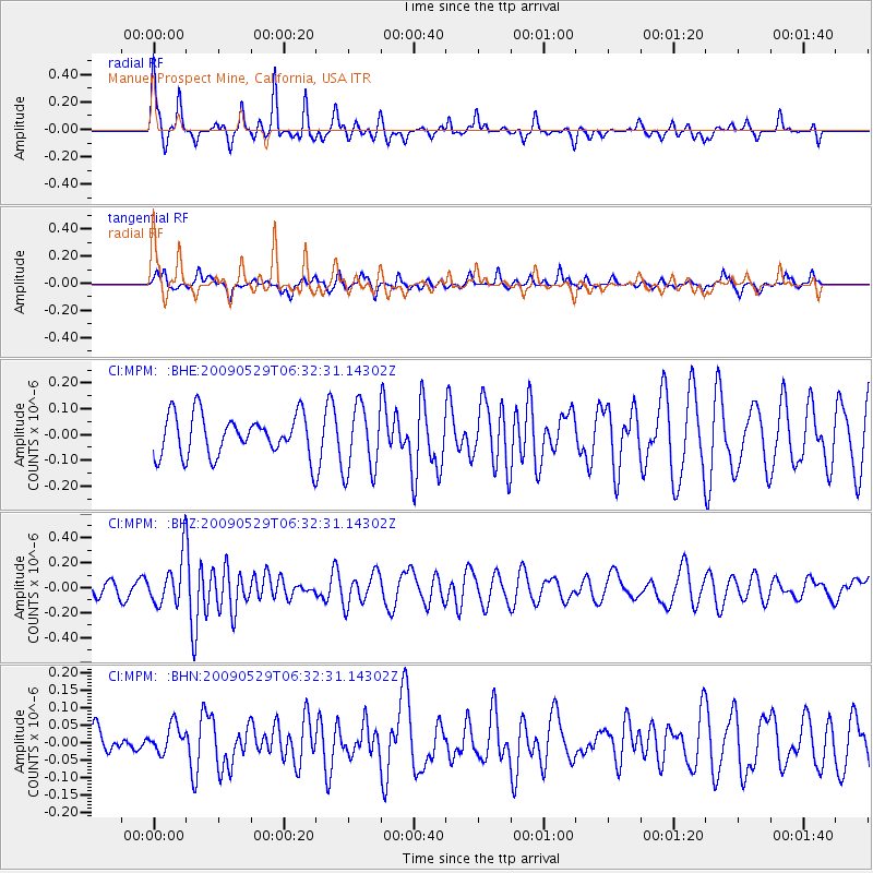
MPM Manuel Prospect Mine, California, USA - Earthquake Result Viewer
*The percent match for this event was below the threshold and hence no stack was calculated.
| Earthquake location: |
Vanuatu Islands |
| Earthquake latitude/longitude: |
-17.0/168.3 |
| Earthquake time(UTC): |
2009/05/29 (149) 06:20:14 GMT |
| Earthquake Depth: |
13 km |
| Earthquake Magnitude: |
5.5 MB, 5.5 MS, 5.7 MW, 5.6 MW |
| Earthquake Catalog/Contributor: |
WHDF/NEIC |
|
| Network: |
CI Caltech Regional Seismic Network |
| Station: |
MPM Manuel Prospect Mine, California, USA |
| Lat/Lon: |
36.06 N/117.49 W |
| Elevation: |
185 m |
|
| Distance: |
87.7 deg |
| Az: |
51.285 deg |
| Baz: |
247.111 deg |
| Ray Param: |
$rayparam |
*The percent match for this event was below the threshold and hence was not used in the summary stack. |
|
| Radial Match: |
75.26131 % |
| Radial Bump: |
255 |
| Transverse Match: |
56.342003 % |
| Transverse Bump: |
305 |
| SOD ConfigId: |
2648 |
| Insert Time: |
2010-03-05 20:28:50.728 +0000 |
| GWidth: |
2.5 |
| Max Bumps: |
400 |
| Tol: |
0.001 |
|
Signal To Noise
| Channel | StoN | STA | LTA |
| CI:MPM: :BHZ:20090529T06:32:31.14302Z | 2.972812 | 1.897551E-7 | 6.383017E-8 |
| CI:MPM: :BHN:20090529T06:32:31.14302Z | 0.8730797 | 3.8941625E-8 | 4.46026E-8 |
| CI:MPM: :BHE:20090529T06:32:31.14302Z | 1.6578282 | 1.3196214E-7 | 7.95994E-8 |
| Arrivals |
| Ps | |
| PpPs | |
| PsPs/PpSs | |


