You are here: Home > Network List > CI - Caltech Regional Seismic Network Stations List
> Station MPM Manuel Prospect Mine, California, USA > Earthquake Result Viewer
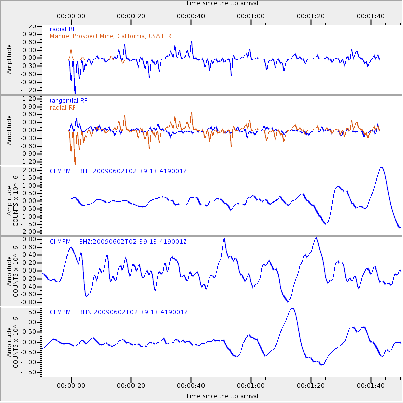
MPM Manuel Prospect Mine, California, USA - Earthquake Result Viewer
*The percent match for this event was below the threshold and hence no stack was calculated.
| Earthquake location: |
Vanuatu Islands |
| Earthquake latitude/longitude: |
-17.8/167.9 |
| Earthquake time(UTC): |
2009/06/02 (153) 02:26:53 GMT |
| Earthquake Depth: |
15 km |
| Earthquake Magnitude: |
5.5 MB |
| Earthquake Catalog/Contributor: |
WHDF/NEIC |
|
| Network: |
CI Caltech Regional Seismic Network |
| Station: |
MPM Manuel Prospect Mine, California, USA |
| Lat/Lon: |
36.06 N/117.49 W |
| Elevation: |
185 m |
|
| Distance: |
88.5 deg |
| Az: |
51.415 deg |
| Baz: |
246.821 deg |
| Ray Param: |
$rayparam |
*The percent match for this event was below the threshold and hence was not used in the summary stack. |
|
| Radial Match: |
77.63749 % |
| Radial Bump: |
303 |
| Transverse Match: |
71.77186 % |
| Transverse Bump: |
371 |
| SOD ConfigId: |
2648 |
| Insert Time: |
2010-03-05 20:28:51.842 +0000 |
| GWidth: |
2.5 |
| Max Bumps: |
400 |
| Tol: |
0.001 |
|
Signal To Noise
| Channel | StoN | STA | LTA |
| CI:MPM: :BHZ:20090602T02:39:13.419001Z | 2.7623065 | 4.5428308E-7 | 1.6445789E-7 |
| CI:MPM: :BHN:20090602T02:39:13.419001Z | 0.57336164 | 9.274033E-8 | 1.617484E-7 |
| CI:MPM: :BHE:20090602T02:39:13.419001Z | 1.6460534 | 2.4766197E-7 | 1.5045805E-7 |
| Arrivals |
| Ps | |
| PpPs | |
| PsPs/PpSs | |


