You are here: Home > Network List > IU - Global Seismograph Network (GSN - IRIS/USGS) Stations List
> Station RSSD Black Hills, South Dakota, USA > Earthquake Result Viewer
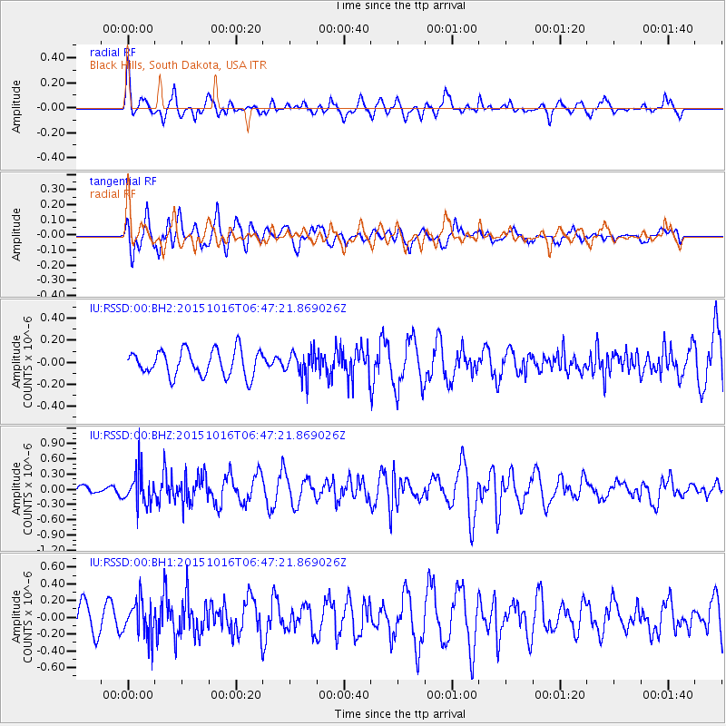
RSSD Black Hills, South Dakota, USA - Earthquake Result Viewer
*The percent match for this event was below the threshold and hence no stack was calculated.
| Earthquake location: |
Kamchatka Peninsula, Russia |
| Earthquake latitude/longitude: |
55.6/159.2 |
| Earthquake time(UTC): |
2015/10/16 (289) 06:38:26 GMT |
| Earthquake Depth: |
285 km |
| Earthquake Magnitude: |
5.6 MWW, 5.7 MWB |
| Earthquake Catalog/Contributor: |
NEIC PDE/NEIC COMCAT |
|
| Network: |
IU Global Seismograph Network (GSN - IRIS/USGS) |
| Station: |
RSSD Black Hills, South Dakota, USA |
| Lat/Lon: |
44.12 N/104.04 W |
| Elevation: |
2090 m |
|
| Distance: |
58.5 deg |
| Az: |
57.054 deg |
| Baz: |
318.595 deg |
| Ray Param: |
$rayparam |
*The percent match for this event was below the threshold and hence was not used in the summary stack. |
|
| Radial Match: |
47.938995 % |
| Radial Bump: |
337 |
| Transverse Match: |
71.50153 % |
| Transverse Bump: |
400 |
| SOD ConfigId: |
1259291 |
| Insert Time: |
2015-11-06 15:25:32.977 +0000 |
| GWidth: |
2.5 |
| Max Bumps: |
400 |
| Tol: |
0.001 |
|
Signal To Noise
| Channel | StoN | STA | LTA |
| IU:RSSD:00:BHZ:20151016T06:47:21.869026Z | 3.486712 | 3.3166404E-7 | 9.512229E-8 |
| IU:RSSD:00:BH1:20151016T06:47:21.869026Z | 1.13377 | 2.1900281E-7 | 1.9316336E-7 |
| IU:RSSD:00:BH2:20151016T06:47:21.869026Z | 0.94505733 | 1.1052683E-7 | 1.1695251E-7 |
| Arrivals |
| Ps | |
| PpPs | |
| PsPs/PpSs | |


